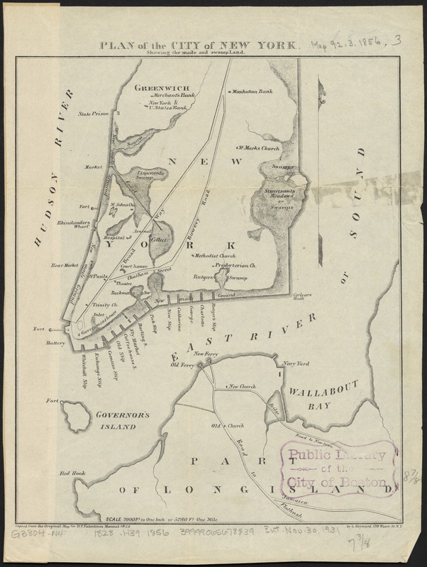
Plan of the city of New York : showing the made and swamp land
Item Information
- Title:
- Plan of the city of New York : showing the made and swamp land
- Creator:
- Hayward, George, approximately 1800-
- Name on Item:
-
by G. Hayward, 120 Water St. N.Y.
- Date:
-
[1856]
- Format:
-
Maps/Atlases
- Location:
-
Boston Public Library
Norman B. Leventhal Map Center - Collection (local):
-
Norman B. Leventhal Map Center Collection
- Subjects:
-
New York (N.Y.)--Maps
Manhattan (New York, N.Y.)--Historical geography--Maps
- Places:
-
New YorkNew YorkManhattan
- Extent:
- 1 map ; 23 x 19 cm
- Terms of Use:
-
No known copyright restrictions.
No known restrictions on use.
- Publisher:
-
New York :
Common Council
- Scale:
-
Scale [ca. 1:24,000]. 2000 ft. to one inch
- Language:
-
English
- Notes:
-
Copied from the original map for D.T. Valentine's Manual 1856.
Shows New York sometime between 1797 and 1828.
- Notes (date):
-
This date is inferred.
- Identifier:
-
06_01_010787
- Call #:
-
G3804.N4:2M3 1828 .H39 1856
- Barcode:
-
39999065678839


