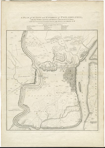
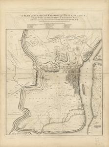
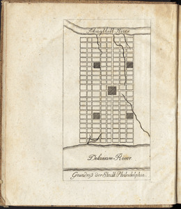
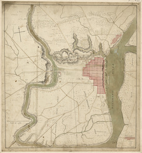
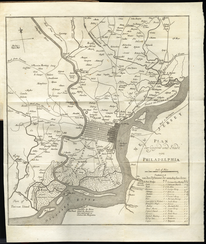
Plan der gegend und stadt von Philadelphia
This map is also available in American Revolutionary Geographies Online (ARGO), a collections portal especially built for material relating to the American Revolutionary War Era. Visit ARGO to learn more about this item and explore the historical geography of North America in the late eighteenth century.
Item Information
- Title:
- Plan der gegend und stadt von Philadelphia
- Creator:
- Korn, Christoph Heinrich, 1726-1783
- Publisher:
- Raspe, Gabriel Nicolaus, 1712-1785
- Date:
-
[1778]
- Format:
-
Maps/Atlases
- Location:
- George Washington's Mount Vernon
- Collection (local):
-
Richard H. Brown Revolutionary War Map Collection at Mount Vernon
- Subjects:
-
Fortification--Pennsylvania--Philadelphia--Maps--Early works to 1800
Philadelphia (Pa.)--History--Revolution, 1775-1783--Maps--Early works to 1800
- Places:
-
Philadelphia (county)Philadelphia
- Extent:
- 1 map ; 36 x 32 cm.
- Terms of Use:
-
No known copyright restrictions.
This work is licensed for use under a Creative Commons Attribution Non-Commercial Share Alike License (CC BY-NC-SA).

- Publisher:
-
Nurnberg :
Gabriel Nicolaus Raspe
- Scale:
-
Scale [ca. 1:54,000]
- Language:
-
German
- Catalog Record:
-
MVLA record
- Notes:
-
Shows forts and batteries.
Includes table of distances.
In the author's Geschichte der kriege in und ausser Europa, zehnter theil (Nurnberg : Gabriel Nicolaus Raspe, 1778).
- Notes (date):
-
This date is inferred.
- Identifier:
-
06_01_010214