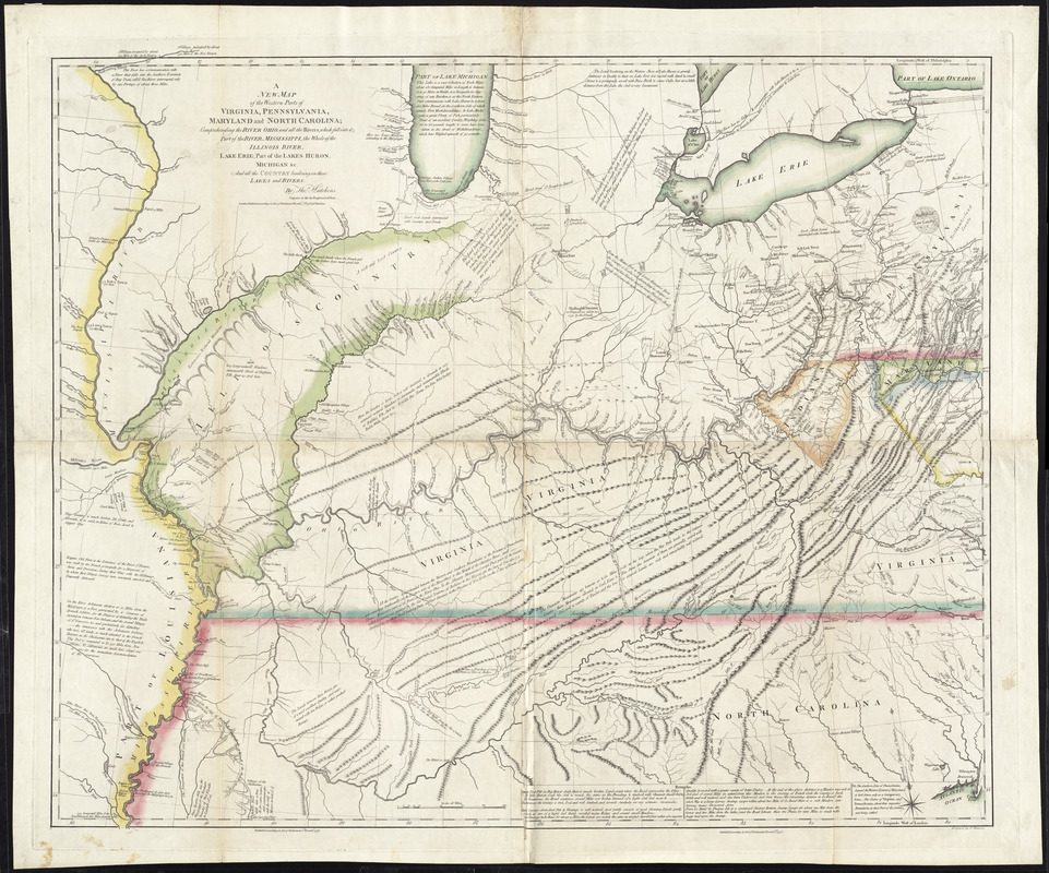
A new map of the western parts of Virginia, Pennsylvania, Maryland and North Carolina : comprehending the river Ohio, and all the rivers, which fall into it; part of the river Mississippi, the whole of the Illinois River, Lake Erie; part of the lakes Huron, Michigan &c. and all the country bordering on these lakes and rivers
This map is also available in American Revolutionary Geographies Online (ARGO), a collections portal especially built for material relating to the American Revolutionary War Era. Visit ARGO to learn more about this item and explore the historical geography of North America in the late eighteenth century.
Item Information
- Title:
- A new map of the western parts of Virginia, Pennsylvania, Maryland and North Carolina : comprehending the river Ohio, and all the rivers, which fall into it; part of the river Mississippi, the whole of the Illinois River, Lake Erie; part of the lakes Huron, Michigan &c. and all the country bordering on these lakes and rivers
- Description:
-
Published in November 1778, Hutchins' map was the first to display in detail the area west of the Appalachian Mountains and east of the Mississippi River. Hutchins based his map on first-hand observations of the area, and surveyed parts of the region himself. He also included descriptions of the natural features, plant-life and animals found in the region, known as "trans-Appalachia.
- Creator:
- Hutchins, Thomas, 1730-1789
- Engraver:
- Cheevers, T.
- Name on Item:
-
by Thos. Hutchins ;engrav'd by T. Cheevers.
- Date:
-
1778
- Format:
-
Maps/Atlases
- Location:
- George Washington's Mount Vernon
- Collection (local):
-
Richard H. Brown Revolutionary War Map Collection at Mount Vernon
- Subjects:
-
Ohio River Valley--Maps--Early works to 1800
Mississippi River Valley--Maps--Early works to 1800
- Places:
-
Mississippi River
Ohio River
- Extent:
- 1 map : hand col. ; 91 x 107 cm.
- Terms of Use:
-
No known copyright restrictions.
This work is licensed for use under a Creative Commons Attribution Non-Commercial Share Alike License (CC BY-NC-SA).

- Publisher:
-
London :
T. Hutchins
- Scale:
-
Scale [ca. 1:1,300,000]
- Language:
-
English
- Catalog Record:
-
MVLA record
- Notes:
-
Relief shown pictorially and by hachures.
Prime meridian: Philadelphia and London.
Includes historical and descriptive notes.
- Identifier:
-
06_01_009624


