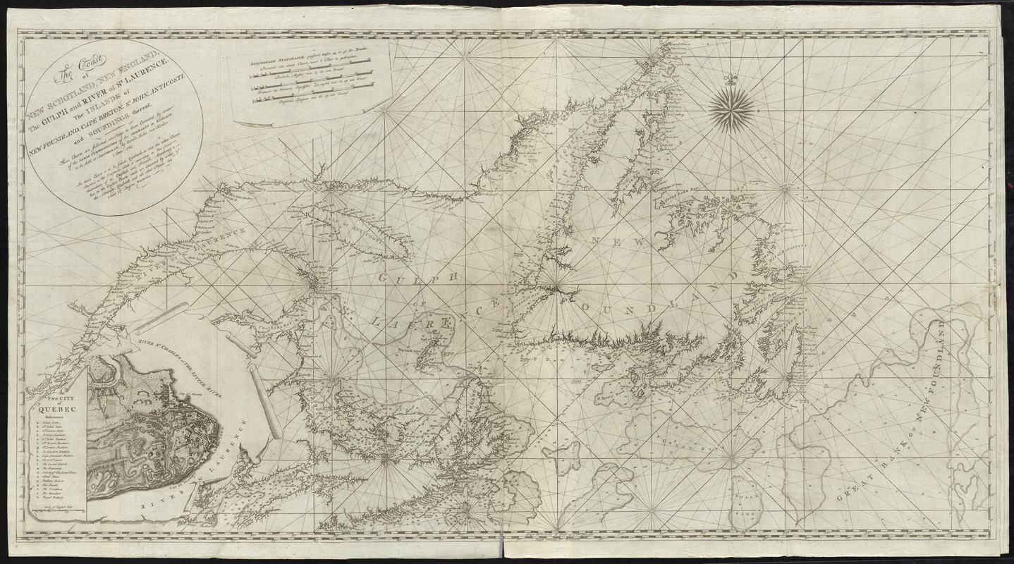
The coast of New Schotland, New England, the gulph and river of St. Laurence : the islands of New Foundland, Cape Breton, St. John, Anticosti, and soundings thereof, these charts are followed, according to them executed by order of the Lords Commissioners of the Admiralty in England
This map is also available in American Revolutionary Geographies Online (ARGO), a collections portal especially built for material relating to the American Revolutionary War Era. Visit ARGO to learn more about this item and explore the historical geography of North America in the late eighteenth century.
Item Information
- Title:
- The coast of New Schotland, New England, the gulph and river of St. Laurence : the islands of New Foundland, Cape Breton, St. John, Anticosti, and soundings thereof, these charts are followed, according to them executed by order of the Lords Commissioners of the Admiralty in England
- Title (alt.):
-
Eene verzameling van nieuwe zee-kaarten van Noord-America in het groot beginnende van Kaap Charles, of de Golf van St. Laurens, tot aan de Golf van Mexico
- Creator:
- Keulen, Gerard van
- Date:
-
1783
- Format:
-
Maps/Atlases
- Location:
- George Washington's Mount Vernon
- Collection (local):
-
Richard H. Brown Revolutionary War Map Collection at Mount Vernon
- Subjects:
-
Nautical charts--Atlantic Coast (Canada)--Early works to 1800
Nautical charts--Saint Lawrence, Gulf of--Early works to 1800
Nautical charts--Maritime Provinces--Early works to 1800
Nautical charts--Newfoundland and Labrador--Early works to 1800
Coasts--Canada--Maps--Early works to 1800
Québec (Québec)--Maps--Early works to 1800
- Places:
-
CanadaQuébec
CanadaSaint Lawrence, Gulf of
- Extent:
- 1 chart ; 58 x 112 cm.
- Terms of Use:
-
No known copyright restrictions.
This work is licensed for use under a Creative Commons Attribution Non-Commercial Share Alike License (CC BY-NC-SA).

- Publisher:
-
Amsterdam :
Gerard Hulst van Keulen
- Scale:
-
Scale [ca. 1:1,600,000]
- Language:
-
English
Dutch
- Catalog Record:
-
MVLA record
- Notes:
-
First of 6 charts bound in a set, apparently an English version of Van Keulen's "Eene verzameling van nieuwe zee-karten van Noord-America," intended for use during the American Revolution.
Prime meridians: Paris, Tenerife, and Greenwich.
Relief shown by hachures. Depths shown by soundings.
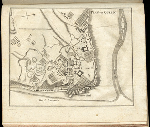
Inset: The city of Quebec.
Chart in English. Scale bar in Dutch.
- Identifier:
-
06_01_009618