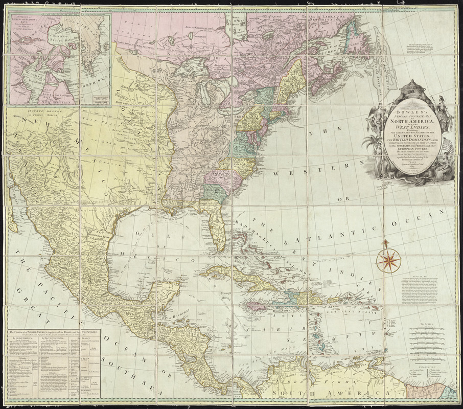
Bowles's new and accurate map of North America and the West Indies : exhibiting the extent and boundaries of the United States, the British dominions, and territories possessed in that quarter by the Spaniards, the French, and other European powers ; the whole compiled and laid down from the best authorities, regulated and divided according to the preliminary Articles of Peace signed at Versailles 20th. Jany. 1783
This map is also available in American Revolutionary Geographies Online (ARGO), a collections portal especially built for material relating to the American Revolutionary War Era. Visit ARGO to learn more about this item and explore the historical geography of North America in the late eighteenth century.
Item Information
- Title:
- Bowles's new and accurate map of North America and the West Indies : exhibiting the extent and boundaries of the United States, the British dominions, and territories possessed in that quarter by the Spaniards, the French, and other European powers ; the whole compiled and laid down from the best authorities, regulated and divided according to the preliminary Articles of Peace signed at Versailles 20th. Jany. 1783
- Creator:
- Bowles, Carington, 1724-1793
- Date:
-
1784
- Format:
-
Maps/Atlases
- Location:
- George Washington's Mount Vernon
- Collection (local):
-
Richard H. Brown Revolutionary War Map Collection at Mount Vernon
- Subjects:
-
North America--Maps--Early works to 1800
- Places:
-
North America (area)
- Extent:
- 1 map : hand col. ; 98 x 113 cm.
- Terms of Use:
-
No known copyright restrictions.
This work is licensed for use under a Creative Commons Attribution Non-Commercial Share Alike License (CC BY-NC-SA).

- Publisher:
-
London :
Carington Bowles
- Scale:
-
Scale [ca. 1:5,500,000]
- Language:
-
English
- Catalog Record:
-
MVLA record
- Notes:
-
Prime meridian: London and Ferro.
Relief shown pictorially.
Inset: Environs of Baffin's and Hudson's Bays, being a supplement to the map of North America.
Includes arcticle 3 of the Treaty of Peace and chart listing areas possessed by various countries.
Panel to left of scale bars mounted upside down.
Imprint trimmed off of lower margin.
- Identifier:
-
06_01_009604


