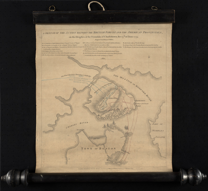
A sketch of the action between the British forces and the American provincials, on the heights of the peninsula of Charlestown, the 17th of June 1775
This map is also available in American Revolutionary Geographies Online (ARGO), a collections portal especially built for material relating to the American Revolutionary War Era. Visit ARGO to learn more about this item and explore the historical geography of North America in the late eighteenth century.
Item Information
- Title:
- A sketch of the action between the British forces and the American provincials, on the heights of the peninsula of Charlestown, the 17th of June 1775
- Description:
-
This map and battle plan immortalized what came to be known as the Battle of Bunker Hill. The alphabetic key identifies British regiments and ships and narrates their actions. The plan also shows earthworks held by the Colonial troops. This detailed plan was published in London only five days after news of the battle itself reached England. Given the haste with which it was prepared, its geographic vagueness in the rendering of Charlestown is less surprising than its overall accuracy and detail.
- Creator:
- Faden, William, 1749-1836
- Creator:
- Jefferys, Thomas, d. 1771
- Name on Item:
-
engravd by Jefferys & Faden.
- Date:
-
1775
- Format:
-
Maps/Atlases
- Location:
- George Washington's Mount Vernon
- Collection (local):
-
Richard H. Brown Revolutionary War Map Collection at Mount Vernon
- Subjects:
-
Bunker Hill, Battle of, Boston, Mass., 1775--Maps--Early works to 1800
Boston (Mass.)--History--Revolution, 1775-1783--Maps--Early works to 1800
- Places:
-
Suffolk (county)BostonBunker Hill
- Extent:
- 1 map : hand col. ; 34 x 31 cm.
- Terms of Use:
-
No known copyright restrictions.
This work is licensed for use under a Creative Commons Attribution Non-Commercial Share Alike License (CC BY-NC-SA).

- Publisher:
-
London :
Jefferys & Faden
- Scale:
-
Scale [ca. 1:13,800]
- Language:
-
English
- Catalog Record:
-
MVLA record
- Notes:
-
Relief shown by hachures.
Indexed for points of military interest.
- Identifier:
-
06_01_009572
- Barcode:
-
30000002804534


