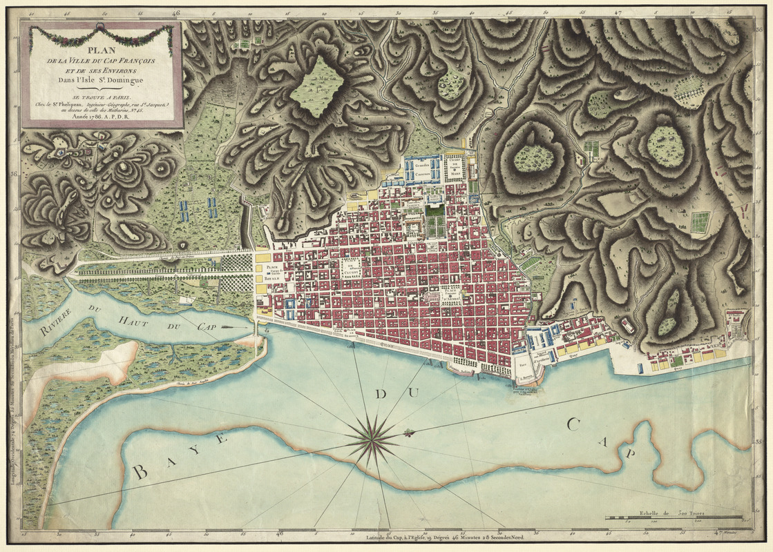
Plan de la ville du Cap Francois et de ses environs dans l'Isle St. Domingue
This map is also available in American Revolutionary Geographies Online (ARGO), a collections portal especially built for material relating to the American Revolutionary War Era. Visit ARGO to learn more about this item and explore the historical geography of North America in the late eighteenth century.
Item Information
- Title:
- Plan de la ville du Cap Francois et de ses environs dans l'Isle St. Domingue
- Contributor:
- Phelipeau, René, fl. 1748-1784
- Date:
-
1786
- Format:
-
Maps/Atlases
- Location:
- George Washington's Mount Vernon
- Collection (local):
-
Richard H. Brown Revolutionary War Map Collection at Mount Vernon
- Subjects:
-
Cap-Haïtien (Haiti)--Maps--Early works to 1800
- Places:
-
NordCap-Haïtien
- Extent:
- 1 map : hand col. ; 40 x 57 cm.
- Terms of Use:
-
No known copyright restrictions.
This work is licensed for use under a Creative Commons Attribution Non-Commercial Share Alike License (CC BY-NC-SA).

- Publisher:
-
Paris :
Chez le Sr. Phelipeau
- Scale:
-
Scale [ca. 1:5,500]
- Language:
-
French
- Catalog Record:
-
MVLA record
- Notes:
-
Oriented with north towards the right.
Prime meridian: Paris. Latitude from Cap de l'Eglise.
Relief shown by hachures.
- Identifier:
-
06_01_009547


![[A map of part of Pennsylvania & Maryland intended to shew, at one view, the several places proposed for opening a communication between the waters of the Delaware & Chesopeak Bays]](https://bpldcassets.blob.core.windows.net/derivatives/images/commonwealth:z603vt12v/image_thumbnail_300.jpg)


