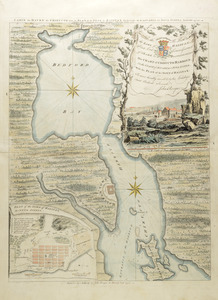
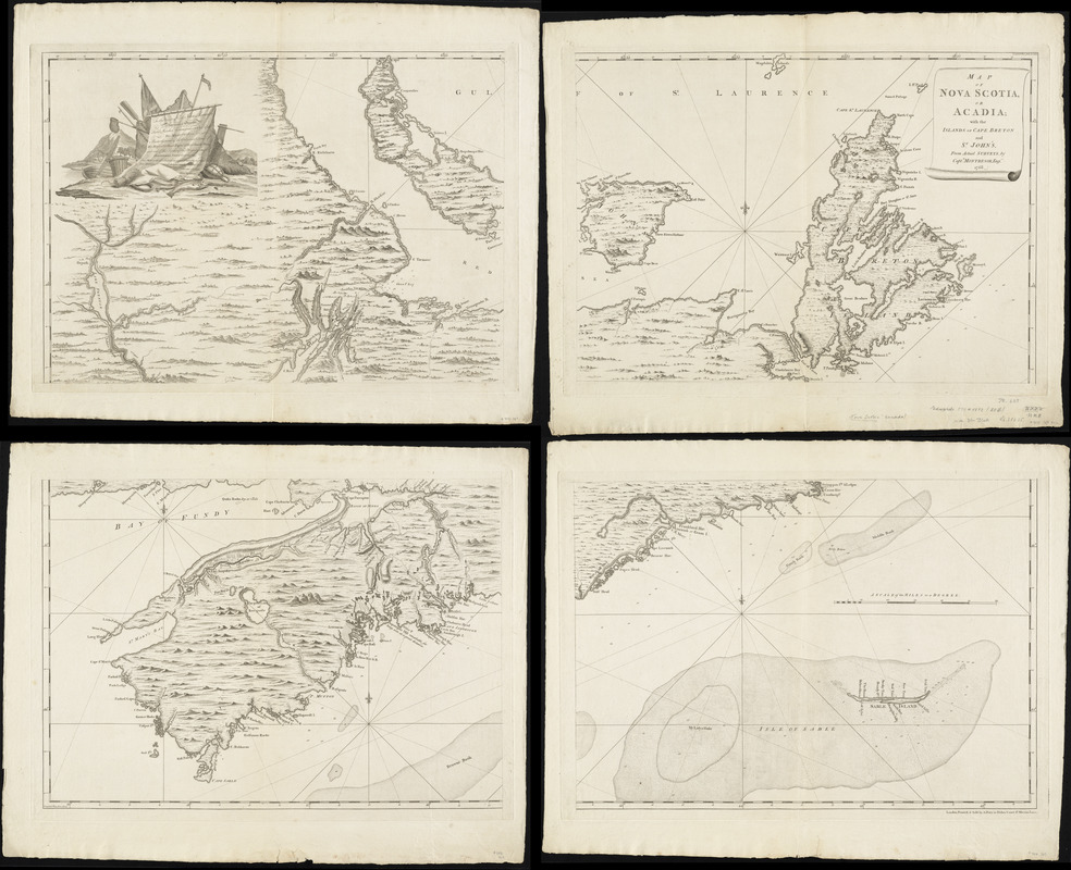
Map of Nova Scotia, or Acadia : with the islands of Cape Breton and St. John's, from actual surveys
This map is also available in American Revolutionary Geographies Online (ARGO), a collections portal especially built for material relating to the American Revolutionary War Era. Visit ARGO to learn more about this item and explore the historical geography of North America in the late eighteenth century.
Item Information
- Title:
- Map of Nova Scotia, or Acadia : with the islands of Cape Breton and St. John's, from actual surveys
- Creator:
- Montrésor, John, 1736-1799
- Publisher:
- Dury, Andrew
- Name on Item:
-
by Captn. Montresor, engir.
- Date:
-
[1768]
- Format:
-
Maps/Atlases
- Location:
- George Washington's Mount Vernon
- Collection (local):
-
Richard H. Brown Revolutionary War Map Collection at Mount Vernon
- Subjects:
-
Nova Scotia--Maps--Early works to 1800
Acadia--Maps--Early works to 1800
Prince Edward Island--Maps--Early works to 1800
Cape Breton Island--Maps--Early works to 1800
- Places:
-
CanadaNova Scotia (province)
- Extent:
- 1 map on 4 sheets ; 100 x 140 cm.
- Terms of Use:
-
No known copyright restrictions.
This work is licensed for use under a Creative Commons Attribution Non-Commercial Share Alike License (CC BY-NC-SA).

- Publisher:
-
London :
Printed & sold by A. Dury
- Scale:
-
Scale [ca. 1:390,000]
- Language:
-
English
- Catalog Record:
-
MVLA record
- Notes:
-
State 1 without parishes on Prince Edward Island.
Relief shown pictorially. Depths shown by soundings.
Prime meridians: London and Ferro.
Inscription to "John Manners" in decorative cartouche depicting fishing iconography.
- Notes (date):
-
This date is inferred.
- Notes (citation):
-
Kershaw, K.A. Early printed maps of Canada, 1703-1799, vol. 3, entry 792
- Identifier:
-
06_01_008545