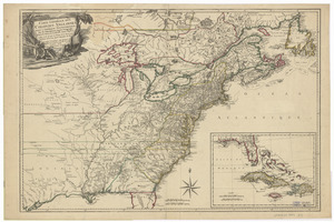
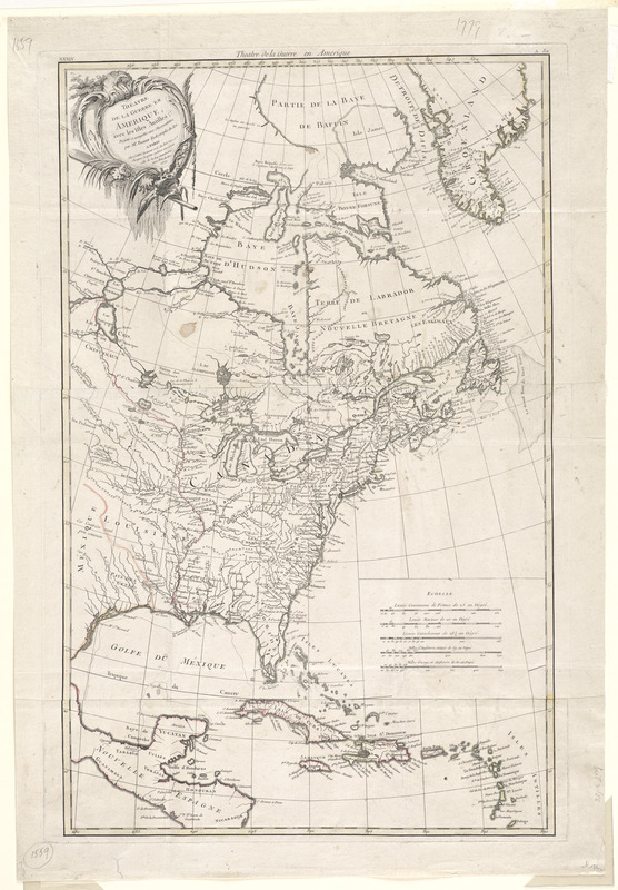
Théatre de la guerre en Amerique, avec les Isles Antilles : projetté et assujettie aux observations
This map is also available in American Revolutionary Geographies Online (ARGO), a collections portal especially built for material relating to the American Revolutionary War Era. Visit ARGO to learn more about this item and explore the historical geography of North America in the late eighteenth century.
Item Information
- Title:
- Théatre de la guerre en Amerique, avec les Isles Antilles : projetté et assujettie aux observations
- Creator:
- Bonne, Rigobert, 1727-1794
- Contributor:
- Lattré, Jean
- Name on Item:
-
par Mr. Bonne.
- Date:
-
1781
- Format:
-
Maps/Atlases
- Location:
- George Washington's Mount Vernon
- Collection (local):
-
Richard H. Brown Revolutionary War Map Collection at Mount Vernon
- Subjects:
-
North America--History--Revolution, 1775-1783--Maps--Early works to 1800
United States--History--Revolution, 1775-1783--Maps--Early works to 1800
Canada--Maps--Early works to 1800
Antilles, Greater--Maps--Early works to 1800
- Places:
-
Greater Antilles (area)
North America (area)
Canada
- Extent:
- 1 map : hand col. ; 58 x 42 cm.
- Terms of Use:
-
No known copyright restrictions.
This work is licensed for use under a Creative Commons Attribution Non-Commercial Share Alike License (CC BY-NC-SA).

- Publisher:
-
Paris :
Lattre
- Scale:
-
Scale [ca. 1:10,500,000]
- Language:
-
French
- Catalog Record:
-
MVLA record
- Notes:
-
Relief shown pictorially.
Meridians numbered eastward from unspecified prime (Long Island at 305°E).
In upper left corner: "XXXIV."
Cataloging, conservation, and digitization made possible in part by The National Endowment for the Humanities: Exploring the human endeavor.
- Identifier:
-
06_01_008531