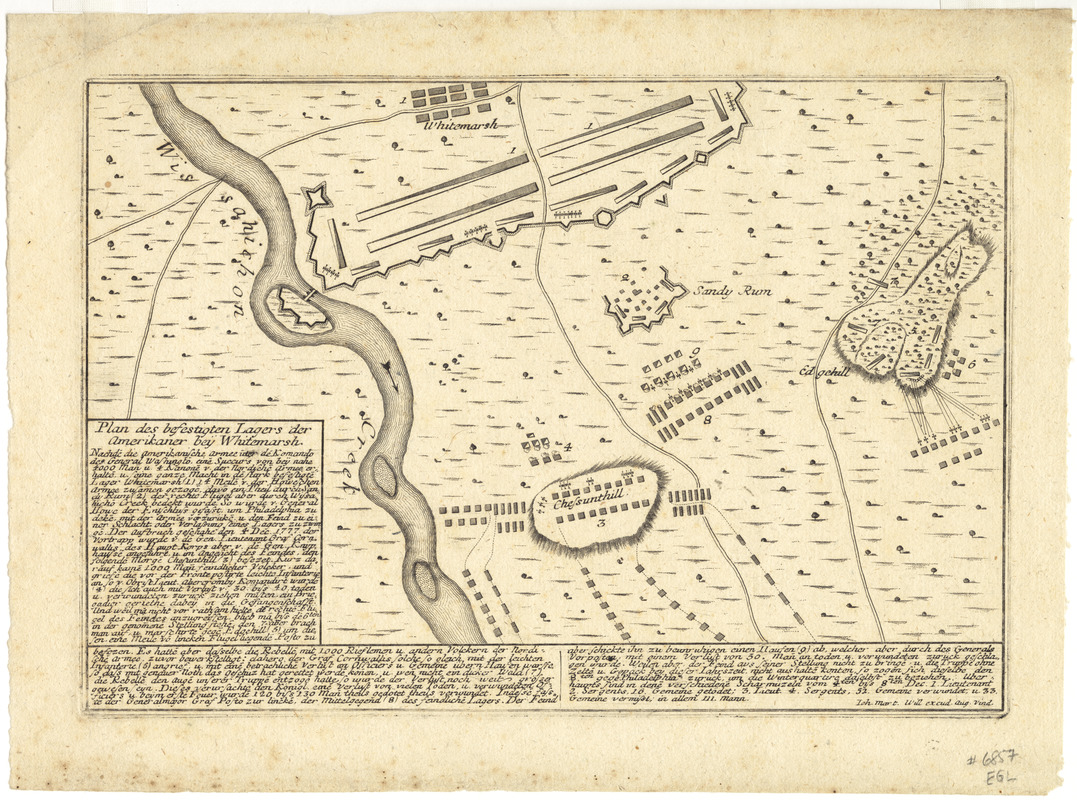
Plan des befestigten lagers der Amerikaner bey Whitemarsh
This map is also available in American Revolutionary Geographies Online (ARGO), a collections portal especially built for material relating to the American Revolutionary War Era. Visit ARGO to learn more about this item and explore the historical geography of North America in the late eighteenth century.
Item Information
- Title:
- Plan des befestigten lagers der Amerikaner bey Whitemarsh
- Creator:
- Will, Johann Martin, 1727-1806
- Name on Item:
-
Joh. Mart. Will excudit.
- Date:
-
[1777?]
- Format:
-
Maps/Atlases
- Location:
- George Washington's Mount Vernon
- Collection (local):
-
Richard H. Brown Revolutionary War Map Collection at Mount Vernon
- Subjects:
-
Philadelphia Campaign, 1777-1778--Maps--Early works to 1800
Whitemarsh (Pa. : Township)--History--18th century--Maps--Early works to 1800
- Places:
-
Montgomery (county)Whitemarsh Township
- Extent:
- 1 map ; 18 x 29 cm.
- Terms of Use:
-
No known copyright restrictions.
This work is licensed for use under a Creative Commons Attribution Non-Commercial Share Alike License (CC BY-NC-SA).

- Publisher:
-
Augsburg :
Joh. Mart. Will
- Scale:
-
Not drawn to scale
- Language:
-
German
- Catalog Record:
-
MVLA record
- Notes:
-
Shows Battle of Whitemarsh.
Relief shown pictorially.
Includes text and references.
- Identifier:
-
06_01_008511


![[A map of part of Pennsylvania & Maryland intended to shew, at one view, the several places proposed for opening a communication between the waters of the Delaware & Chesopeak Bays]](https://bpldcassets.blob.core.windows.net/derivatives/images/commonwealth:z603vt12v/image_thumbnail_300.jpg)
