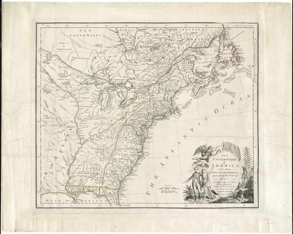
The United States of America laid down from the best authorities, agreeable to the Peace of 1783
This map is also available in American Revolutionary Geographies Online (ARGO), a collections portal especially built for material relating to the American Revolutionary War Era. Visit ARGO to learn more about this item and explore the historical geography of North America in the late eighteenth century.
Item Information
- Title:
- The United States of America laid down from the best authorities, agreeable to the Peace of 1783
- Description:
-
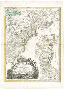
Londoner John Wallis published one of the earliest maps of the new United States. It offered visual evidence of the nation's geography by delineating state boundaries, Native American lands, and the remaining French and Spanish holdings. The cartouche in the lower right links the country's outline with symbols that became national icons. On the left, George Washington walks alongside the figure of Liberty, while Athena (goddess of wisdom) and the blindfolded figure of Justice assist a seated Benjamin Franklin on the right. The scene occurs beneath an American flag with thirteen stars and stripes. This was the first British map to illustrate the flag.
- Creator:
- Wallis, John, 1714-1793
- Date:
-
1783
- Format:
-
Maps/Atlases
- Location:
- George Washington's Mount Vernon
- Collection (local):
-
Richard H. Brown Revolutionary War Map Collection at Mount Vernon
- Subjects:
-
Canada, Eastern--Maps--Early works to 1800
United States--Maps--Early works to 1800
- Places:
-
Eastern United States (area)
CanadaProvince of New Brunswick (province)
- Extent:
- 1 map : hand col. ; 47 x 56 cm.
- Terms of Use:
-
No known copyright restrictions.
This work is licensed for use under a Creative Commons Attribution Non-Commercial Share Alike License (CC BY-NC-SA).

- Publisher:
-
London :
John Wallis
- Scale:
-
Scale [ca. 1:6,640,000]
- Language:
-
English
- Catalog Record:
-
MVLA record
- Notes:
-
Shows the 13 states, Louisiana, and parts of Canada and Florida.
Relief shown pictorially.
Prime meridian: London.
Decorative title cartouche.
This map can be viewed as a georeferenced overlay in an interactive application made especially for We Are One: Mapping America's Road from Revolution to Independence http://d2o8owo4k087al.cloudfront.net/index.html?mapId=98.
- Notes (exhibitions):
-
Exhibited: "We Are One: Mapping America's Road from Revolution to Independence" organized by the Norman B. Leventhal Map Center at the Boston Public Library, 2015.
- Identifier:
-
06_01_008205