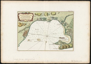
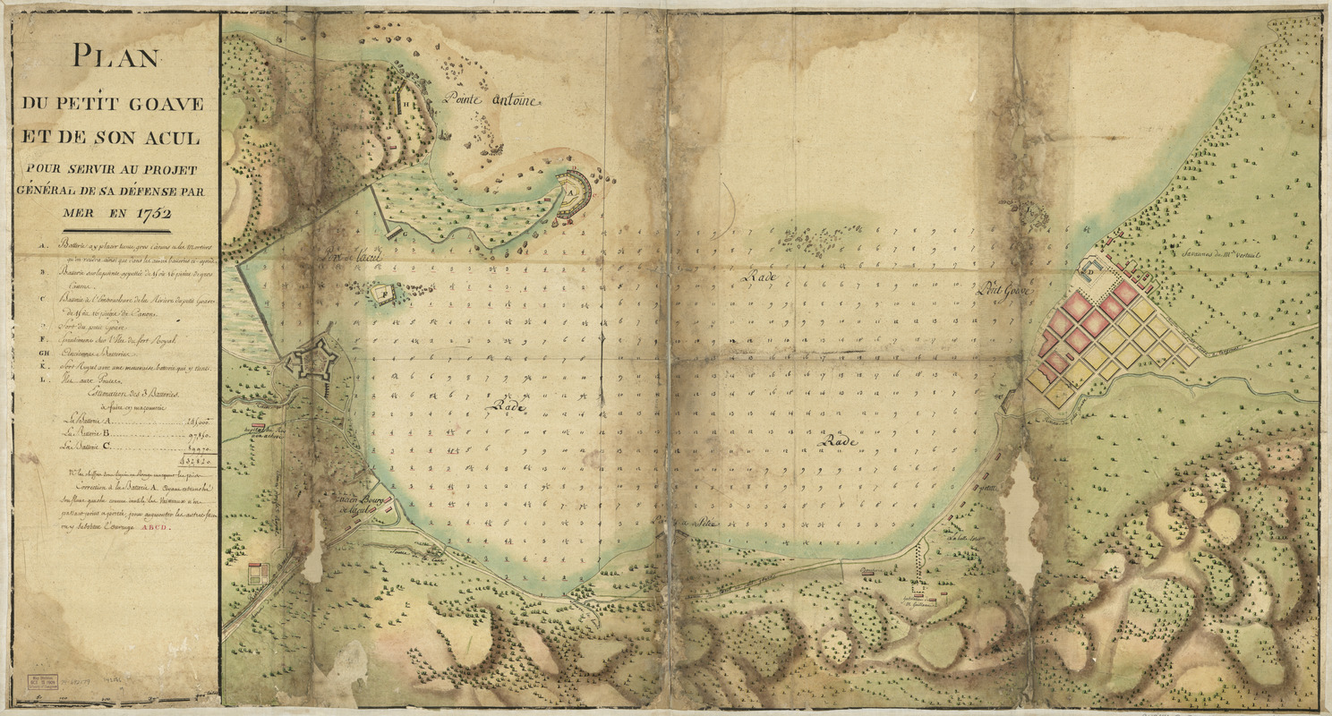
Plan du Petit Goâve et de son acul pour servir au projet général de sa défense par mer en 1752
This map is also available in American Revolutionary Geographies Online (ARGO), a collections portal especially built for material relating to the American Revolutionary War Era. Visit ARGO to learn more about this item and explore the historical geography of North America in the late eighteenth century.
Item Information
- Title:
- Plan du Petit Goâve et de son acul pour servir au projet général de sa défense par mer en 1752
- Date:
-
[1752]
- Format:
-
Maps/Atlases
Manuscripts
- Location:
- Library of Congress Geography and Map Division
- Collection (local):
-
Library of Congress Collection
- Subjects:
-
Harbors--Haiti--Petit Goâve--Maps--Early works to 1800
Petit Goâve (Haiti)--Maps--Early works to 1800
Fortification--Haiti--Petit Goâve--Maps--Early works to 1800
- Places:
-
OuestPetit-Goâve
- Extent:
- 1 manuscript map : hand color 63 x 177 cm.
- Terms of Use:
-
No known copyright restrictions.
This work is licensed for use under a Creative Commons Attribution Non-Commercial Share Alike License (CC BY-NC-SA).

- Scale:
-
Scale ca. 1:5,200
- Language:
-
French
- Catalog Record:
-
https://lccn.loc.gov/74692179
- Notes:
-
Manuscript, pen-and-ink and watercolor, on tracing paper.
Has watermark.
Relief shown by shading. Depths shown by soundings.
Imperfect: Deteriorated and discolored along folds.
On verso, upper left corner: No. 22. [changed to] 12.
- Notes (date):
-
This date is inferred.
- Notes (citation):
-
LC Luso-Hispanic World, 472
LC Maps of North America, 1750-1789, 1893
- Identifier:
-
ar189300