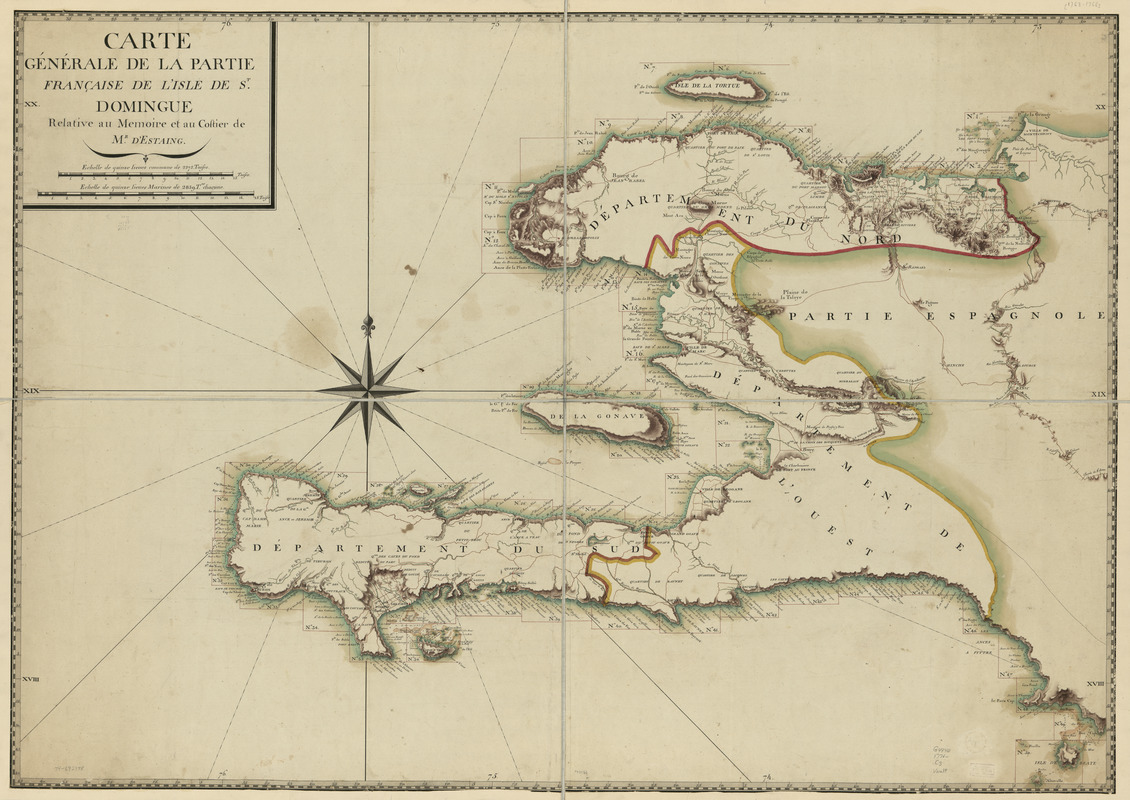
Carte générale de la partie française de l'isle de St. Domingue
This map is also available in American Revolutionary Geographies Online (ARGO), a collections portal especially built for material relating to the American Revolutionary War Era. Visit ARGO to learn more about this item and explore the historical geography of North America in the late eighteenth century.
Item Information
- Title:
- Carte générale de la partie française de l'isle de St. Domingue
- Name on Item:
-
Relative au mémoire et au costier de Mr. d'Estaing
- Date:
-
[1776?]
- Format:
-
Maps/Atlases
Manuscripts
- Location:
- Library of Congress Geography and Map Division
- Collection (local):
-
Library of Congress Collection
- Subjects:
-
Haiti--Maps--Early works to 1800
- Places:
-
Haiti
- Extent:
- 1 manuscript map : hand color 87 x 124 cm.
- Terms of Use:
-
No known copyright restrictions.
This work is licensed for use under a Creative Commons Attribution Non-Commercial Share Alike License (CC BY-NC-SA).

- Scale:
-
Scale ca. 1:350,000
- Language:
-
French
- Catalog Record:
-
https://lccn.loc.gov/74692178
- Notes:
-
Manuscript, pen-and-ink and watercolor.
Has watermark.
Relief shown by shading. Depths shown by soundings.
Index map to coastal charts, with coastline divided into 50 sections.
- Notes (citation):
-
LC Luso-Hispanic World, 451
LC Maps of North America, 1750-1789, 1869
- Identifier:
-
ar186900