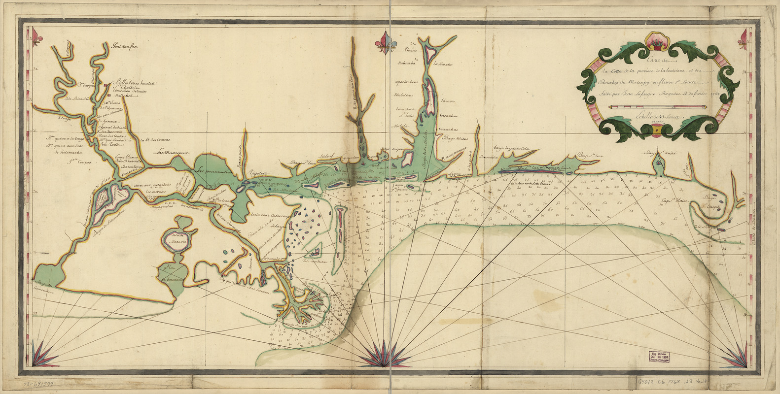
Carte de la coste de la province de la Louisiane et des bouches du Micissipy ou fleuve St. Louis
This map is also available in American Revolutionary Geographies Online (ARGO), a collections portal especially built for material relating to the American Revolutionary War Era. Visit ARGO to learn more about this item and explore the historical geography of North America in the late eighteenth century.
Item Information
- Title:
- Carte de la coste de la province de la Louisiane et des bouches du Micissipy ou fleuve St. Louis
- Title (alt.):
-
Province de la Louisiane et des bouches du Micissipy ou fleuve St. Louis
- Creator:
- Lefargue, Jean
- Name on Item:
-
faite par Jean Lefargue, Bayonne, le 20 fevrier, 1768
- Date:
-
[1768]
- Format:
-
Maps/Atlases
Manuscripts
- Location:
- Library of Congress Geography and Map Division
- Collection (local):
-
Library of Congress Collection
- Subjects:
-
Gulf Coast (La.)--Maps--Early works to 1800
Gulf Coast (U.S.)--Maps--Early works to 1800
Mississippi Sound--Maps, Manuscript--Early works to 1800
- Places:
-
Mississippi Sound (bay)
Louisiana
- Extent:
- 1 manuscript map : hand color 47 x 96 cm.
- Terms of Use:
-
No known copyright restrictions.
This work is licensed for use under a Creative Commons Attribution Non-Commercial Share Alike License (CC BY-NC-SA).

- Scale:
-
Scale ca. 1:700,000
- Language:
-
French
- Catalog Record:
-
https://lccn.loc.gov/73691599
- Notes:
-
Manuscript, pen-and-ink and watercolor.
Soundings shown in fathoms.
Shows the coast from "Baye de l'Ascencion," Louisiana to "Baye St. Joseph," Florida.
- Notes (date):
-
This date is inferred.
- Notes (citation):
-
LC Maps of North America, 1750-1789, 1603
LC Luso-Hispanic World, 821
- Identifier:
-
ar160300z