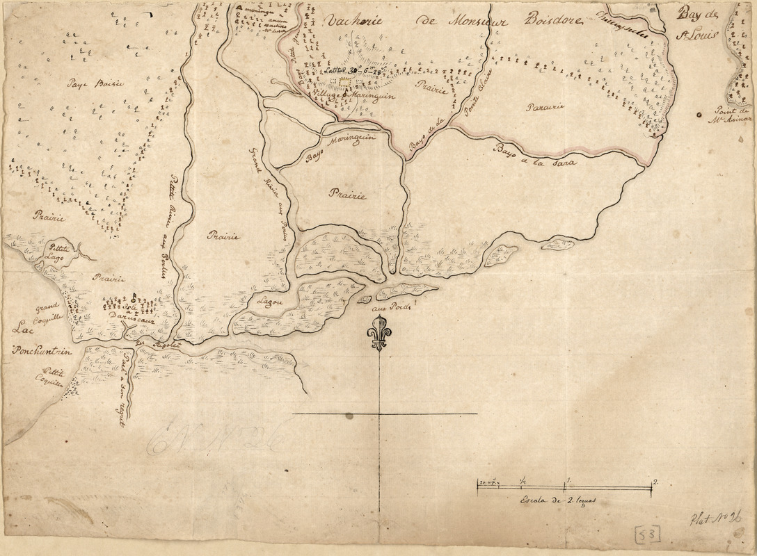
Map of the Rigolet and the mouth of the Pearl River, Louisiana and Mississippi
This map is also available in American Revolutionary Geographies Online (ARGO), a collections portal especially built for material relating to the American Revolutionary War Era. Visit ARGO to learn more about this item and explore the historical geography of North America in the late eighteenth century.
Item Information
- Title:
- Map of the Rigolet and the mouth of the Pearl River, Louisiana and Mississippi
- Creator:
- Pintado, Vicente Sebastián, 1774-1829
- Date:
-
[ca. 1800]
- Format:
-
Maps/Atlases
Manuscripts
- Location:
- Library of Congress Geography and Map Division
- Collection (local):
-
Library of Congress Collection
- Subjects:
-
Pearl River Region (Miss. and La.)--Maps
Manuscript maps
- Places:
-
Pearl River
- Extent:
- 1 ms. map ; on sheet 28 x 40 cm.
- Terms of Use:
-
No known copyright restrictions.
This work is licensed for use under a Creative Commons Attribution Non-Commercial Share Alike License (CC BY-NC-SA).

- Scale:
-
Scale indeterminable
- Language:
-
English
Spanish
- Catalog Record:
-
https://lccn.loc.gov/2013585063
- Notes:
-
Relief shown by hachures.
Title from John R. Hébert's list of maps.
Pen-and-ink.
Watermarks: Horn in a shield surmounted by a crown over the letters GR.
From the papers of Vicente Sebastián Pintado.
Described in: Vicente Sebastián Pintado, Surveyor General of Spanish West Florida, 1805-17 : the man and his maps / by John R. Hébert. Imago mundi, v. 39, pp. 50-72. 1987. p. 70, no. 53.
In lower right corner: Plat no 26.
- Notes (citation):
-
LC Luso-Hispanic World, 944
- Identifier:
-
lh000944


![Armstrong C[ount]y](https://bpldcassets.blob.core.windows.net/derivatives/images/commonwealth:q524ng353/image_thumbnail_300.jpg)


