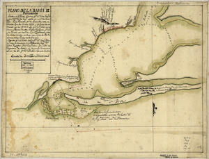
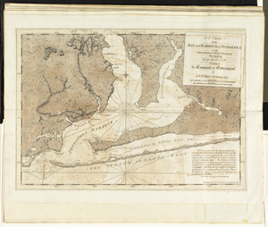
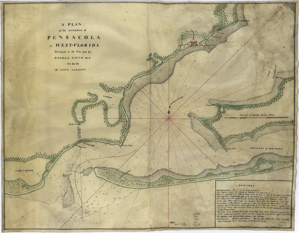
A plan of the harbour of Pensacola in West-Florida
This map is also available in American Revolutionary Geographies Online (ARGO), a collections portal especially built for material relating to the American Revolutionary War Era. Visit ARGO to learn more about this item and explore the historical geography of North America in the late eighteenth century.
Item Information
- Title:
- A plan of the harbour of Pensacola in West-Florida
- Creator:
- Gauld, George
- Contributor:
- Lindsay, John, Sir, 1737-1788
- Name on Item:
-
Surveyed in the year 1764 by George Gauld, M.A. The bar by Sir John Lindsay
- Date:
-
[1764]
- Format:
-
Maps/Atlases
Manuscripts
- Location:
- Library of Congress Geography and Map Division
- Collection (local):
-
Library of Congress Collection
- Subjects:
-
Pensacola Bay (Fla.)--Maps, Manuscript--Early works to 1800
Harbors--Florida--Pensacola--Maps--Early works to 1800
- Places:
-
Pensacola Bay
- Extent:
- 1 manuscript map : hand color; 55 x 69 cm.
- Terms of Use:
-
No known copyright restrictions.
This work is licensed for use under a Creative Commons Attribution Non-Commercial Share Alike License (CC BY-NC-SA).

- Scale:
-
Scale ca. 1:32,500
- Language:
-
English
- Catalog Record:
-
https://lccn.loc.gov/73691619
- Notes:
-
Manuscript, pen-and-ink and watercolor, on vellum.
Soundings shown in fathoms at low tide.
Includes "Remarks."
- Notes (date):
-
This date is inferred.
- Notes (citation):
-
LC Maps of North America, 1750-1789, 1656
LC Luso-Hispanic World, 892
- Identifier:
-
ar165600