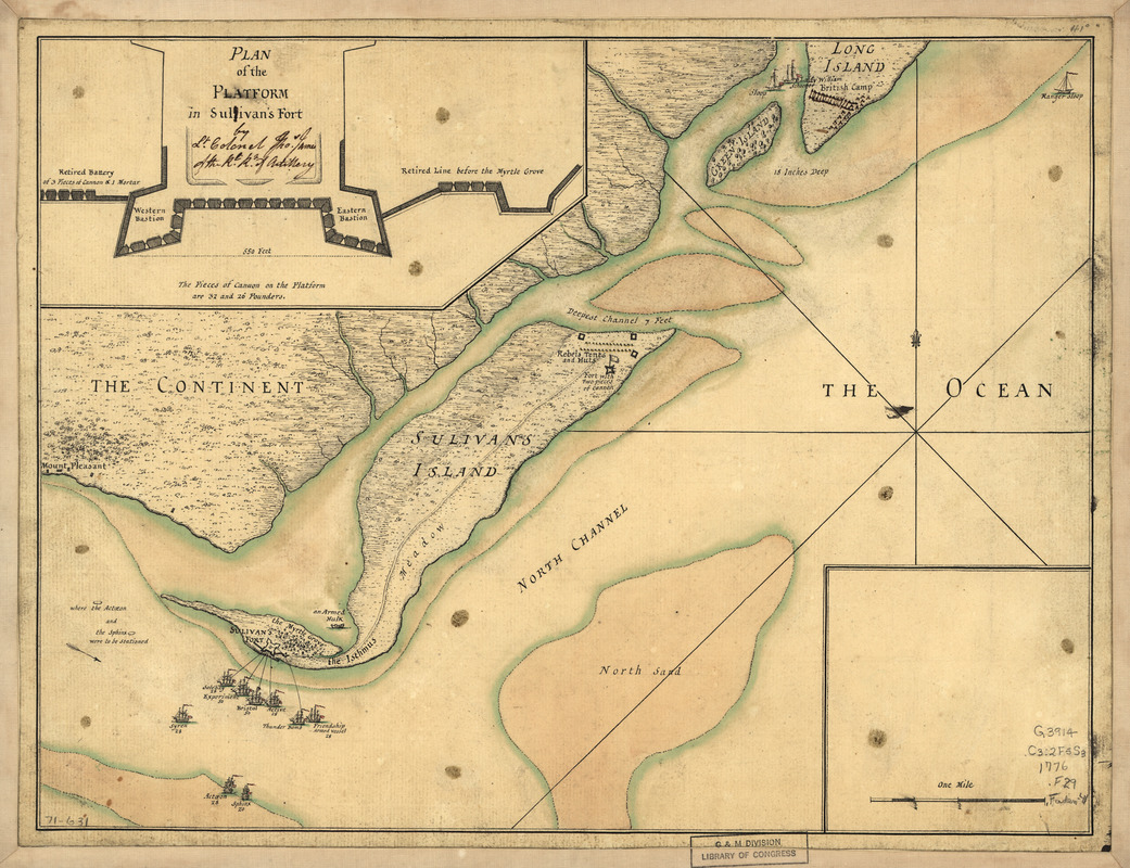
A plan of the attack of Fort Sulivan : near Charles Town in South Carolina by a squadron of His Majesty's ships on the 28th day of June 1776, with the disposition of the King's land forces and the encampments and entrenchments of the rebels, from the drawings made on the spot
This map is also available in American Revolutionary Geographies Online (ARGO), a collections portal especially built for material relating to the American Revolutionary War Era. Visit ARGO to learn more about this item and explore the historical geography of North America in the late eighteenth century.
Item Information
- Title:
- A plan of the attack of Fort Sulivan : near Charles Town in South Carolina by a squadron of His Majesty's ships on the 28th day of June 1776, with the disposition of the King's land forces and the encampments and entrenchments of the rebels, from the drawings made on the spot
- Creator:
- Faden, William, 1749-1836
- Contributor:
- James, Thomas
- Date:
-
[1776]
- Format:
-
Maps/Atlases
Manuscripts
- Location:
- Library of Congress Geography and Map Division
- Collection (local):
-
Library of Congress Collection
- Subjects:
-
Fort Moultrie, Battle of, S.C., 1776--Maps, Manuscript--Early works to 1800
Fort Moultrie (S.C.)--Maps--Early works to 1800
- Places:
-
Charleston (county)Fort Moultrie
- Extent:
- 1 manuscript map : hand color 29 x 38 cm.
- Terms of Use:
-
No known copyright restrictions.
This work is licensed for use under a Creative Commons Attribution Non-Commercial Share Alike License (CC BY-NC-SA).

- Scale:
-
Scale ca. 1:25,500
- Language:
-
English
- Catalog Record:
-
https://lccn.loc.gov/gm71000631
- Notes:
-
Title from engraved map published by Faden in 1776.
Manuscript, pen-and-ink and watercolor.
Includes inset "Plan of the platform in Sullivan's Fort." Annotated by Lt. Colonel Thos. James of the Rl. Rt. of Artillery, to delete one "l" from "Sullivan's Fort."
- Notes (date):
-
This date is inferred.
- Notes (citation):
-
LC Maps of North America, 1750-1789 1544
- Identifier:
-
ar154400


