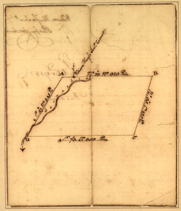
Plat of a survey for William Hughes, Jr. of 460 acres in Frederick County, Va. on the Cacapon River
This map is also available in American Revolutionary Geographies Online (ARGO), a collections portal especially built for material relating to the American Revolutionary War Era. Visit ARGO to learn more about this item and explore the historical geography of North America in the late eighteenth century.
Item Information
- Title:
- Plat of a survey for William Hughes, Jr. of 460 acres in Frederick County, Va. on the Cacapon River
- Creator:
- Washington, George, 1732-1799
- Date:
-
1750
- Format:
-
Maps/Atlases
Manuscripts
- Location:
- Library of Congress Geography and Map Division
- Collection (local):
-
Library of Congress Collection
- Subjects:
-
Real property--West Virginia--Hampshire County--Maps--Early works to 1800
Real property--West Virginia--Morgan County--Maps--Early works to 1800
Hampshire County (W. Va.)--Surveys--Maps, Manuscript--Early works to 1800
Morgan County (W. Va.)--Surveys--Maps, Manuscript--Early works to 1800
- Places:
-
Morgan (county)
Hampshire (county)
- Extent:
- 1 map : ms. ; 18 x 16 cm., on sheet 31 x 26 cm.
- Terms of Use:
-
No known copyright restrictions.
This work is licensed for use under a Creative Commons Attribution Non-Commercial Share Alike License (CC BY-NC-SA).

- Scale:
-
Scale not given
- Language:
-
English
- Catalog Record:
-
https://lccn.loc.gov/97684083
- Notes:
-
Title from Lawrence Martin's The George Washington Atlas. 1932.
Survey plot is located either in Hampshire County or Morgan County, W. Va.
Handwritten on verso: William Hughes Junr., plat for 460 acres, 1753, deed drawn.
Pen-and-ink.
Mounted on linen covered cardboard.
Accompanied by handwritten surveying notes of April 4, 1750, signed by George Washington.
- Notes (citation):
-
Martin. George Washington atlas, 14a
- Identifier:
-
ar300700


