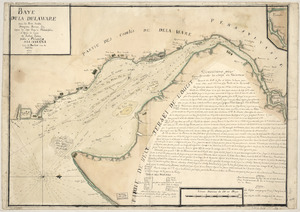
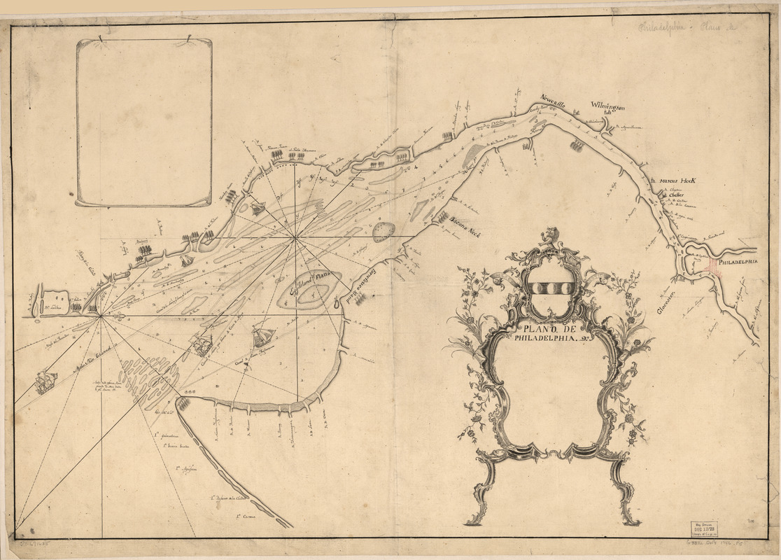
Plano de Philadelphia
This map is also available in American Revolutionary Geographies Online (ARGO), a collections portal especially built for material relating to the American Revolutionary War Era. Visit ARGO to learn more about this item and explore the historical geography of North America in the late eighteenth century.
Item Information
- Title:
- Plano de Philadelphia
- Creator:
- Fisher, Joshua, 1707-1783
- Date:
-
[1770?–1779?]
- Format:
-
Maps/Atlases
Manuscripts
- Location:
- Library of Congress Geography and Map Division
- Collection (local):
-
Library of Congress Collection
- Subjects:
-
Nautical charts--Delaware Bay (Del. and N.J.)--Early works to 1800
Delaware Bay (Del. and N.J.)--Maps, Manuscript--Early works to 1800
Nautical charts--Delaware River Watershed (N.Y.-Del. and N.J.)--Early works to 1800
Delaware River Watershed (N.Y.-Del. and N.J.)--Maps, Manuscript--Early works to 1800
- Places:
-
Delaware River
Delaware Bay
- Extent:
- 1 manuscript map 49 x 72 cm.
- Terms of Use:
-
No known copyright restrictions.
This work is licensed for use under a Creative Commons Attribution Non-Commercial Share Alike License (CC BY-NC-SA).

- Scale:
-
Scale ca. 1:220,000
- Language:
-
French
- Catalog Record:
-
https://lccn.loc.gov/74691685
- Notes:
-
Manuscript, pen and ink.
Copied from Joshua Fishers' "To the merchants & insurers of the city of Philadelphia, this chart of Delaware Bay and river."
Depths shown in fathoms.
Oriented with north to the right.
Shows shipping channels.
- Notes (citation):
-
LC Maps of North America, 1750-1789, 1353
- Identifier:
-
ar135300