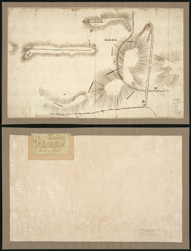
Plan of Genl Du Portail : Plan of the position of Valley Forge after Jany. 1778
This map is also available in American Revolutionary Geographies Online (ARGO), a collections portal especially built for material relating to the American Revolutionary War Era. Visit ARGO to learn more about this item and explore the historical geography of North America in the late eighteenth century.
Item Information
- Title:
- Plan of Genl Du Portail : Plan of the position of Valley Forge after Jany. 1778
- Creator:
- Duportail, Antoine-Jean-Louis Le Bègue de Presle, 1743-1802
- Date:
-
[1778]
- Format:
-
Maps/Atlases
Manuscripts
- Location:
- Library of Congress Geography and Map Division
- Collection (local):
-
Library of Congress Collection
- Subjects:
-
Valley Forge (Pa.)--History--Revolution, 1775-1783--Maps--Early works to 1800
Valley Forge (Pa.)--Maps--Early works to 1800
Fortification--Pennsylvania--Valley Forge--Maps--Early works to 1800
Valley Forge (Pa.)--Buildings, structures, etc--Maps--Early works to 1800
- Places:
-
Chester (county)Valley Forge
- Extent:
- 1 manuscript map on sheet 24 x 38 cm.
- Terms of Use:
-
No known copyright restrictions.
This work is licensed for use under a Creative Commons Attribution Non-Commercial Share Alike License (CC BY-NC-SA).

- Scale:
-
Scale not given
- Language:
-
English
- Catalog Record:
-
https://lccn.loc.gov/gm71000935
- Notes:
-
Relief shown by hachures.
Title from verso.
Manuscript, pen-and-ink.
Annotated in pencil to show some distances. Annotated bar scale shows scale ca. 14,000.
- Notes (date):
-
This date is inferred.
- Notes (citation):
-
LC Maps of North America, 1750-1789, 1349
- Identifier:
-
ar134900z


