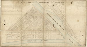
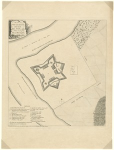
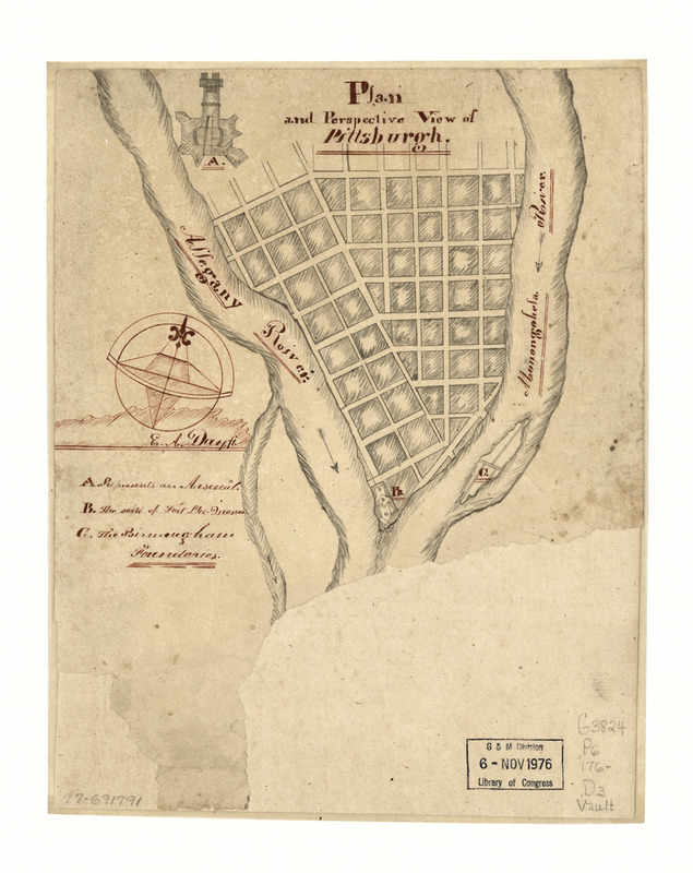
Plan and perspective view of Pittsburgh
This map is also available in American Revolutionary Geographies Online (ARGO), a collections portal especially built for material relating to the American Revolutionary War Era. Visit ARGO to learn more about this item and explore the historical geography of North America in the late eighteenth century.
Item Information
- Title:
- Plan and perspective view of Pittsburgh
- Creator:
- Day, E. A.
- Name on Item:
-
[Signed] E. A. Day ft.
- Date:
-
[1760?–1769?]
- Format:
-
Maps/Atlases
Manuscripts
- Location:
- Library of Congress Geography and Map Division
- Collection (local):
-
Library of Congress Collection
- Subjects:
-
Pittsburgh (Pa.)--Maps--Early works to 1800
- Places:
-
Allegheny (county)Pittsburgh
- Extent:
- 1 manuscript map : hand color on sheet 26 x 21 cm.
- Terms of Use:
-
No known copyright restrictions.
This work is licensed for use under a Creative Commons Attribution Non-Commercial Share Alike License (CC BY-NC-SA).

- Scale:
-
Scale not given
- Language:
-
English
- Catalog Record:
-
https://lccn.loc.gov/77691791
- Notes:
-
Date from dealers catalog: [1760-70]
Manuscript; pen-and-ink and watercolor.
Includes index to points of interest and illus.
Oriented with north to the left, not towards the upper right as shown by compass rose.
- Notes (citation):
-
LC Maps of North America, 1750-1789, 1330
- Identifier:
-
ar133000