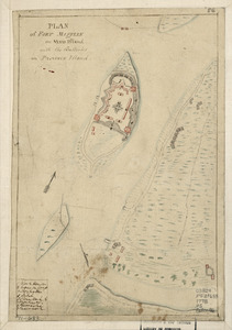
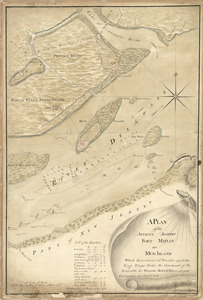
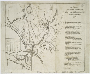
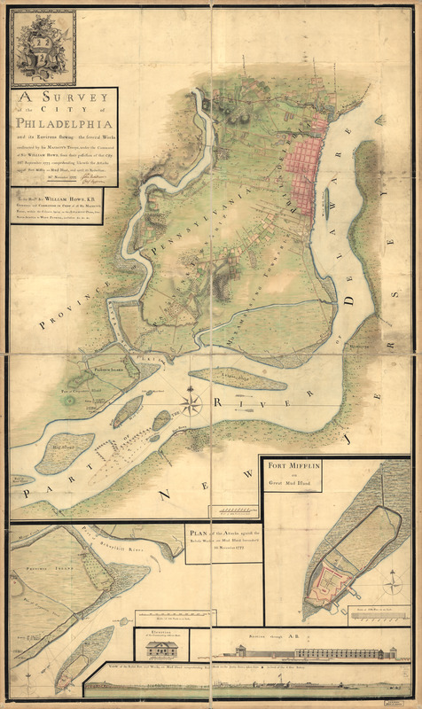
A survey of the city of Philadelphia and its environs : shewing the several works constructed by His Majesty's troops, under the command of Sir William Howe, since their possession of that city 26th. September 1777, comprehending likewise the attacks against Fort Mifflin on Mud Island, and until it's reduction, 16th November 1777
This map is also available in American Revolutionary Geographies Online (ARGO), a collections portal especially built for material relating to the American Revolutionary War Era. Visit ARGO to learn more about this item and explore the historical geography of North America in the late eighteenth century.
Item Information
- Title:
- A survey of the city of Philadelphia and its environs : shewing the several works constructed by His Majesty's troops, under the command of Sir William Howe, since their possession of that city 26th. September 1777, comprehending likewise the attacks against Fort Mifflin on Mud Island, and until it's reduction, 16th November 1777
- Creator:
- Nicole, Pierre, -1784
- Contributor:
- Montrésor, John, 1736-1799
- Name on Item:
-
Surveyed & drawn by P. Nicole
- Date:
-
[1777?]
- Format:
-
Maps/Atlases
Manuscripts
- Location:
- Library of Congress Geography and Map Division
- Collection (local):
-
Library of Congress Collection
- Subjects:
-
Philadelphia (Pa.)--History--Revolution, 1775-1783--Maps, Manuscript--Early works to 1800
Fort Mifflin (Philadelphia, Pa.)--Maps--Early works to 1800
- Places:
-
Philadelphia (county)Philadelphia
Fort Mifflin
- Extent:
- 1 manuscript map : hand color; 151 x 89 cm.
- Terms of Use:
-
No known copyright restrictions.
This work is licensed for use under a Creative Commons Attribution Non-Commercial Share Alike License (CC BY-NC-SA).

- Scale:
-
Scale 1:14,400
- Language:
-
English
- Catalog Record:
-
https://lccn.loc.gov/gm71000933
- Notes:
-
Manuscript, pen-and-ink and watercolor.
Relief shown by shading.
Annotated: John Montresor, chief engineer.
Map sections individually titled: Fort Mifflin on Great Mud Island [1:2,400]--Plan of the attacks against the rebels works on Mud Island surrender'd 16. November 1777 [1:7,200]--View of the rebel fort and works, on Mud Island comprehending Red-Bank on the Jersey shore; taken from * in front of the 6 gun battery Elevation of the commanding officer's house Section through A:B [1:600].
- Notes (citation):
-
LC Maps of North America, 1750-1789, 1315
- Identifier:
-
ar302200z