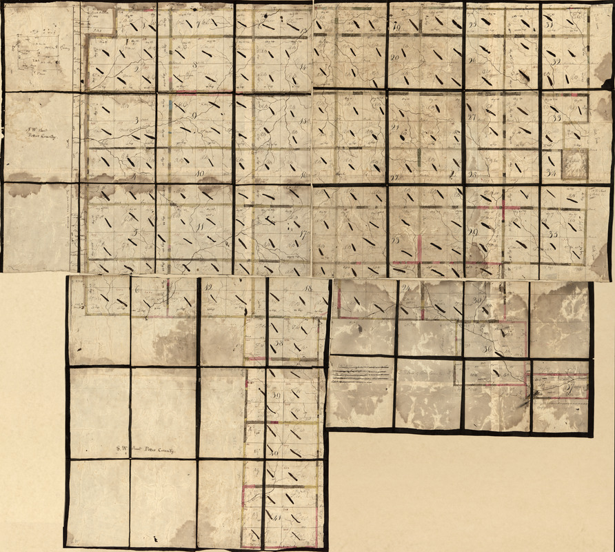
Land ownership map of the William Bingham estate in Potter County, Pennsylvania
This map is also available in American Revolutionary Geographies Online (ARGO), a collections portal especially built for material relating to the American Revolutionary War Era. Visit ARGO to learn more about this item and explore the historical geography of North America in the late eighteenth century.
Item Information
- Title:
- Land ownership map of the William Bingham estate in Potter County, Pennsylvania
- Title (alt.):
-
Potter County, Pennsylvania
Potter County
- Creator:
- Adlum, John, 1759-1836
- Contributor:
- Bingham, William, 1752-1804
- Name on Item:
-
surveyed by John Adlum
- Date:
-
[1790?–1799?]
- Format:
-
Maps/Atlases
Manuscripts
- Location:
- Library of Congress Geography and Map Division
- Collection (local):
-
Library of Congress Collection
- Subjects:
-
Real property--Pennsylvania--Potter County--Maps--Early works to 1800
Boundaries (Estates)--Pennsylvania--Potter County--Maps--Early works to 1800
Manuscript maps--Early works to 1800
Potter County (Pa.)--Maps--Early works to 1800
- Places:
-
Potter (county)
- Extent:
- 1 map on 4 sheets : ms., col., sectioned and mounted on cloth ; 85 x 121 cm., sheets 56 x 62 cm. or smaller, folded to 18 x 16 cm. or smaller.
- Terms of Use:
-
No known copyright restrictions.
This work is licensed for use under a Creative Commons Attribution Non-Commercial Share Alike License (CC BY-NC-SA).

- Scale:
-
Scale [ca. 1:40,000]
- Language:
-
English
- Table of Contents:
-
NW sheet Potter County
N.E. sheet Potter Co.
S.E. sheet of Potter County
S.W. sheet Potter County.
- Catalog Record:
-
https://lccn.loc.gov/86694762
- Notes:
-
Shows lots, boundaries, numbers, and dimensions.
From the William Bingham estate maps.
Sectional title label affixed on verso of each sheet.
Pen-and-ink, pencil, and watercolor.
Some sheets include note and inset.
- Identifier:
-
la002159


