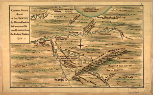
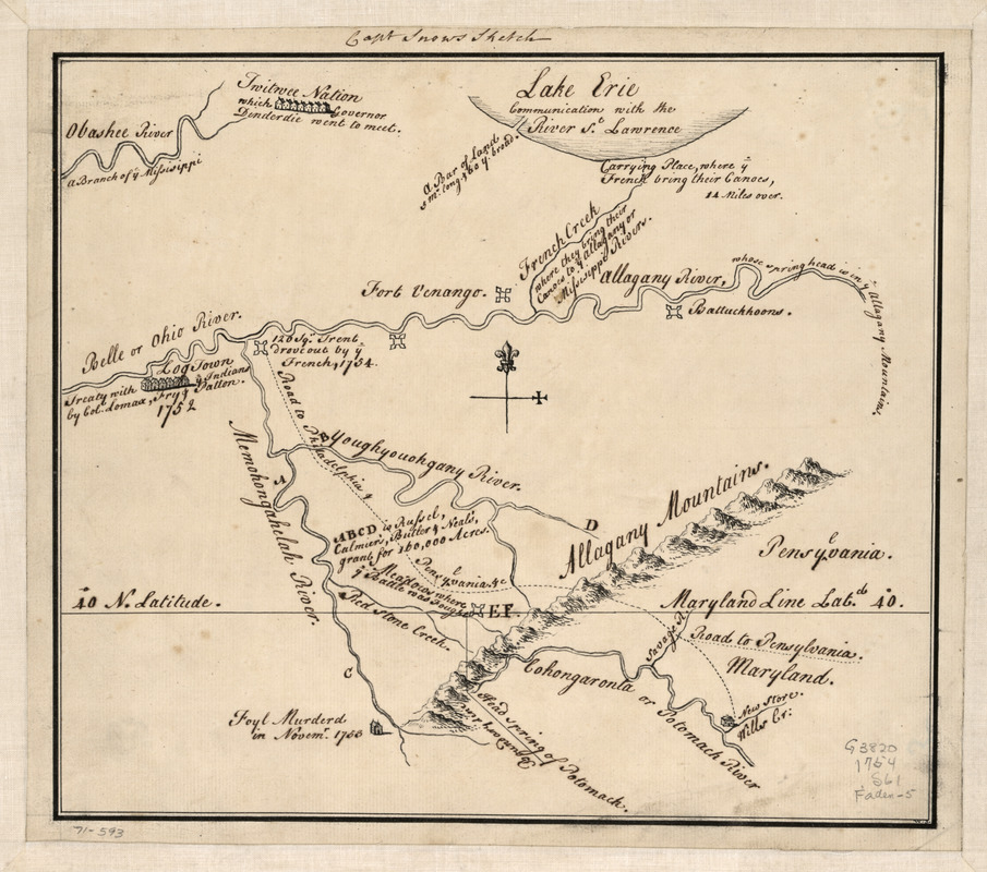
Captain Snow's sketch
This map is also available in American Revolutionary Geographies Online (ARGO), a collections portal especially built for material relating to the American Revolutionary War Era. Visit ARGO to learn more about this item and explore the historical geography of North America in the late eighteenth century.
Item Information
- Title:
- Captain Snow's sketch
- Creator:
- Snow, Capt.
- Date:
-
[1754]
- Format:
-
Maps/Atlases
Manuscripts
- Location:
- Library of Congress Geography and Map Division
- Collection (local):
-
Library of Congress Collection
- Subjects:
-
Pennsylvania--Maps, Manuscript--Early works to 1800
Maryland--Maps, Manuscript--Early works to 1800
- Places:
-
Maryland
Pennsylvania
- Extent:
- 1 manuscript map 22 x 26 cm.
- Terms of Use:
-
No known copyright restrictions.
This work is licensed for use under a Creative Commons Attribution Non-Commercial Share Alike License (CC BY-NC-SA).

- Scale:
-
Scale not given
- Language:
-
English
- Catalog Record:
-
https://lccn.loc.gov/gm71000593
- Notes:
-
Manuscript, pen-and-ink.
Relief shown pictorially.
Shows location of forts, western Pennsylvania, northern Virginia, northern Maryland, Maryland-Pennsylvania boundary line, and "Road to Philadelphia & Pensylvania, &c."
Includes historical notes.
- Notes (date):
-
This date is inferred.
- Notes (citation):
-
LC Maps of North America, 1750-1789, 1302
- Identifier:
-
ar130200