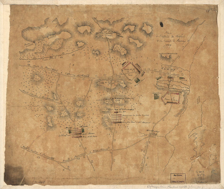
Plan de l'affaire de Westfield & du camp de Raway
This map is also available in American Revolutionary Geographies Online (ARGO), a collections portal especially built for material relating to the American Revolutionary War Era. Visit ARGO to learn more about this item and explore the historical geography of North America in the late eighteenth century.
Item Information
- Title:
- Plan de l'affaire de Westfield & du camp de Raway
- Title (alt.):
-
Westfield & du camp de Raway
Raway
- Creator:
- Wangenheim, Friedrich Adam Julius von
- Date:
-
1777
- Format:
-
Maps/Atlases
Manuscripts
- Location:
- Library of Congress Geography and Map Division
- Collection (local):
-
Library of Congress Collection
- Subjects:
-
Essex County (N.J.)--History--Revolution, 1775-1783--Maps, Manuscript--Early works to 1800
Union County (N.J.)--History--Revolution, 1775-1783--Maps, Manuscript--Early works to 1800
- Places:
-
Essex (county)
Union (county)
- Extent:
- 1 manuscript map : hand color ; on sheet 33 x 40 cm.
- Terms of Use:
-
No known copyright restrictions.
This work is licensed for use under a Creative Commons Attribution Non-Commercial Share Alike License (CC BY-NC-SA).

- Scale:
-
Scale ca. 1:50,000
- Language:
-
French
- Catalog Record:
-
https://lccn.loc.gov/gm71000668
- Notes:
-
Manuscript, pen-and-ink and watercolor on tracing paper.
Relief shown by hachures.
Shows troop positions in Essex and Union counties, New Jersey and location of camps near Rahway for the 26th and 27th of June.
- Notes (citation):
-
LC Maps of North America, 1750-1789, 1278
- Identifier:
-
ar127800


