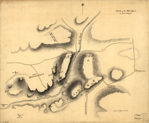
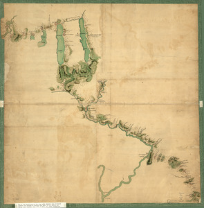
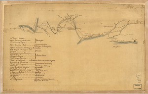
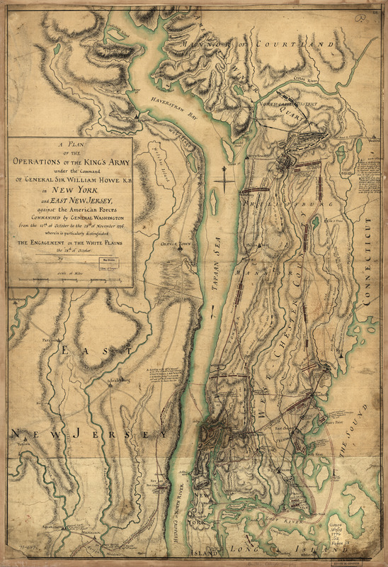
A plan of the operations of the King's army : under the command of General Sir William Howe, K.B. in New York and east New Jersey, against the American forces commanded by General Washington from the 12th of October to the 28th of November 1776, wherein is particularly distinguished the engagement on the White Plains the 28th of October
This map is also available in American Revolutionary Geographies Online (ARGO), a collections portal especially built for material relating to the American Revolutionary War Era. Visit ARGO to learn more about this item and explore the historical geography of North America in the late eighteenth century.
Item Information
- Title:
- A plan of the operations of the King's army : under the command of General Sir William Howe, K.B. in New York and east New Jersey, against the American forces commanded by General Washington from the 12th of October to the 28th of November 1776, wherein is particularly distinguished the engagement on the White Plains the 28th of October
- Creator:
- Sauthier, Claude Joseph
- Name on Item:
-
By [C. J. Sauthier
- Date:
-
[1776?]
- Format:
-
Maps/Atlases
Manuscripts
- Location:
- Library of Congress Geography and Map Division
- Collection (local):
-
Library of Congress Collection
- Subjects:
-
White Plains, Battle of, White Plains, N.Y., 1776--Maps, Manuscript--Early works to 1800
New York (State)--History--Revolution, 1775-1783--Maps, Manuscript--Early works to 1800
New Jersey--History--Revolution, 1775-1783--Maps, Manuscript--Early works to 1800
- Places:
-
New York
Westchester (county)White Plains
Bergen (county)
- Extent:
- 1 manuscript map : hand color 74 x 51 cm.
- Terms of Use:
-
No known copyright restrictions.
This work is licensed for use under a Creative Commons Attribution Non-Commercial Share Alike License (CC BY-NC-SA).

- Scale:
-
Scale ca. 1:85,000
- Language:
-
English
- Catalog Record:
-
https://lccn.loc.gov/gm71000649
- Notes:
-
Manuscript, pen-and-ink and watercolor.
Has watermark.
Relief shown by hachures.
Includes descriptive notes.
- Notes (citation):
-
LC Maps of North America, 1750-1789, 1054
- Identifier:
-
ar105400