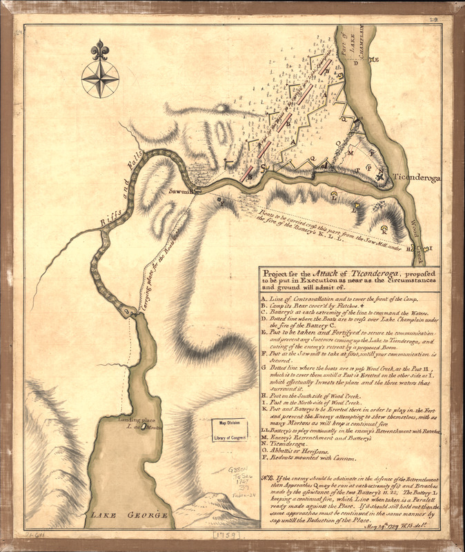
Project for the attack of Ticonderoga : proposed to be put in execution as near as the circumstances and ground will admit of. May 29th. 1759
This map is also available in American Revolutionary Geographies Online (ARGO), a collections portal especially built for material relating to the American Revolutionary War Era. Visit ARGO to learn more about this item and explore the historical geography of North America in the late eighteenth century.
Item Information
- Title:
- Project for the attack of Ticonderoga : proposed to be put in execution as near as the circumstances and ground will admit of. May 29th. 1759
- Creator:
- Brasier, William
- Name on Item:
-
W. B. delt.
- Date:
-
[1759]
- Format:
-
Maps/Atlases
Manuscripts
- Location:
- Library of Congress Geography and Map Division
- Collection (local):
-
Library of Congress Collection
- Subjects:
-
Ticonderoga Region (N.Y.)--History--French and Indian War, 1754-1763--Maps, Manuscript--Early works to 1800
Fort Ticonderoga (N.Y.)--History--French and Indian War, 1754-1763--Maps, Manuscript--Early works to 1800
- Places:
-
Fort Ticonderoga (historical)
- Extent:
- 1 manuscript map : hand color 38 x 31 cm.
- Terms of Use:
-
No known copyright restrictions.
This work is licensed for use under a Creative Commons Attribution Non-Commercial Share Alike License (CC BY-NC-SA).

- Scale:
-
Scale ca. 1:15,400
- Language:
-
English
- Catalog Record:
-
https://lccn.loc.gov/gm71000611
- Notes:
-
Manuscript, pen-and-ink and watercolor.
Relief shown by hachures.
Includes index to military positions.
- Notes (date):
-
This date is inferred.
- Identifier:
-
ar300900


