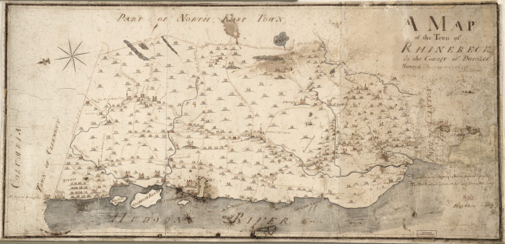
A map of the town of Rhinebeck in the County of Dutchess : surveyed in December 1797 and January 1798
This map is also available in American Revolutionary Geographies Online (ARGO), a collections portal especially built for material relating to the American Revolutionary War Era. Visit ARGO to learn more about this item and explore the historical geography of North America in the late eighteenth century.
Item Information
- Title:
- A map of the town of Rhinebeck in the County of Dutchess : surveyed in December 1797 and January 1798
- Creator:
- Thompson, Alexander, (Surveyor)
- Name on Item:
-
by Alexander Thompson
- Date:
-
1798
- Format:
-
Maps/Atlases
Manuscripts
- Location:
- Library of Congress Geography and Map Division
- Collection (local):
-
Library of Congress Collection
- Subjects:
-
Rhinebeck (N.Y. : Town)--Maps--Early works to 1800
- Places:
-
Dutchess (county)Rhinebeck
- Extent:
- 1 ms. map : col. ; 47 x 100 cm.
- Terms of Use:
-
No known copyright restrictions.
This work is licensed for use under a Creative Commons Attribution Non-Commercial Share Alike License (CC BY-NC-SA).

- Scale:
-
Scale [1:31,680]
- Language:
-
English
- Catalog Record:
-
https://lccn.loc.gov/2010594205
- Notes:
-
Relief shown pictorially.
Shows roads, churches, mills, the Hudson River with landings identified by name.
Pen and ink and watercolor.
Oriented with north to the left.
Copy imperfect: Minor losses and fading, some staining.
- Identifier:
-
ct003566


