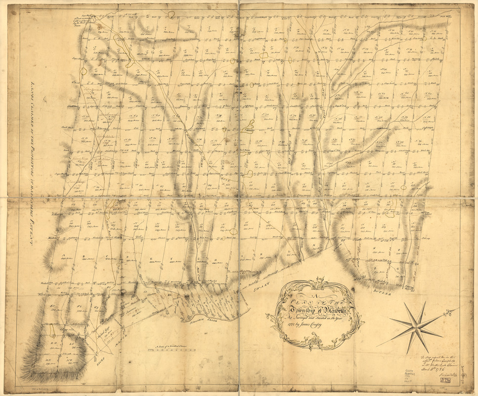
A plan of the township of Blenheim, as surveyed and divided in the year 1772
This map is also available in American Revolutionary Geographies Online (ARGO), a collections portal especially built for material relating to the American Revolutionary War Era. Visit ARGO to learn more about this item and explore the historical geography of North America in the late eighteenth century.
Item Information
- Title:
- A plan of the township of Blenheim, as surveyed and divided in the year 1772
- Creator:
- Creassy, James
- Date:
-
[1772]
- Format:
-
Maps/Atlases
Manuscripts
- Location:
- Library of Congress Geography and Map Division
- Collection (local):
-
Library of Congress Collection
- Subjects:
-
Real property--New York (State)--Blenheim--Maps--Early works to 1800
Land grants--New York (State)--Blenheim--Maps--Early works to 1800
Blenheim, N.Y--Maps, Manuscript--Early works to 1800
- Places:
-
Town of Blenheim
- Extent:
- 1 manuscript map : hand color, 101 x 120 cm.
- Terms of Use:
-
No known copyright restrictions.
This work is licensed for use under a Creative Commons Attribution Non-Commercial Share Alike License (CC BY-NC-SA).

- Scale:
-
Scale ca. 1:16,000
- Language:
-
English
- Catalog Record:
-
https://lccn.loc.gov/74692222
- Notes:
-
Manuscript, pen-and-ink and watercolor.
Oriented with north toward the upper right.
Relief shown by hachures.
Shows names of several landowners.
Annotated: This map referred to, in the affidt. of James Campbell on Mr. Wiatherhead's claim March 4th. 1786. Richard Lee.
In margin: James Campbell.
- Notes (date):
-
This date is inferred.
- Notes (citation):
-
LC Maps of North America, 1750-1789, 1093
- Identifier:
-
ar109300z


