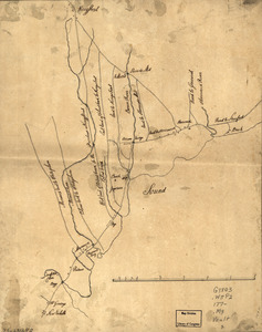
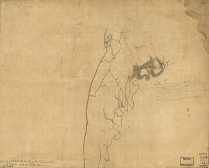
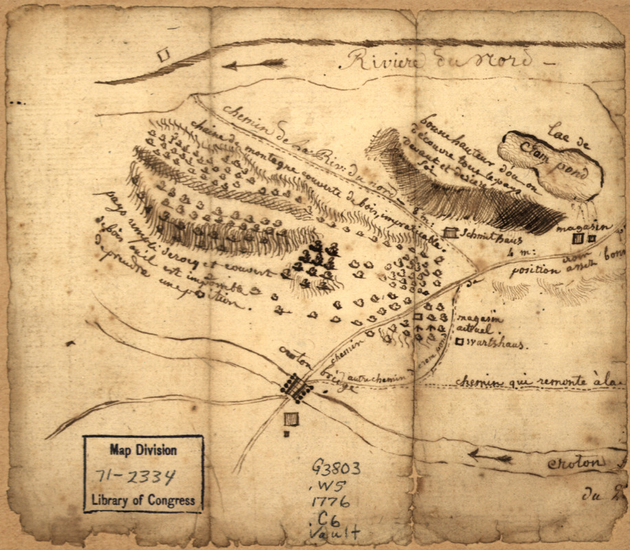
Country between North River and Croton River
This map is also available in American Revolutionary Geographies Online (ARGO), a collections portal especially built for material relating to the American Revolutionary War Era. Visit ARGO to learn more about this item and explore the historical geography of North America in the late eighteenth century.
Item Information
- Title:
- Country between North River and Croton River
- Date:
-
[1776?]
- Format:
-
Maps/Atlases
Manuscripts
- Location:
- Library of Congress Geography and Map Division
- Collection (local):
-
Library of Congress Collection
- Subjects:
-
Westchester County (N.Y.)--Maps, Manuscript--Early works to 1800
- Places:
-
Westchester (county)
- Extent:
- 1 manuscript map, on sheet 12 x 14 cm.
- Terms of Use:
-
No known copyright restrictions.
This work is licensed for use under a Creative Commons Attribution Non-Commercial Share Alike License (CC BY-NC-SA).

- Scale:
-
Scale not given
- Language:
-
French
- Catalog Record:
-
https://lccn.loc.gov/gm71002334
- Notes:
-
Manuscript, pen-and-ink.
Title from manuscript catalog of Peter Force map collection.
Oriented with north to the right.
Relief shown by hachures.
French.
Mounted portion on right side wanting.
Includes notes describing military qualities of the terrain.
- Notes (citation):
-
LC Maps of North America, 1750-1789, 1095
- Identifier:
-
ar109500