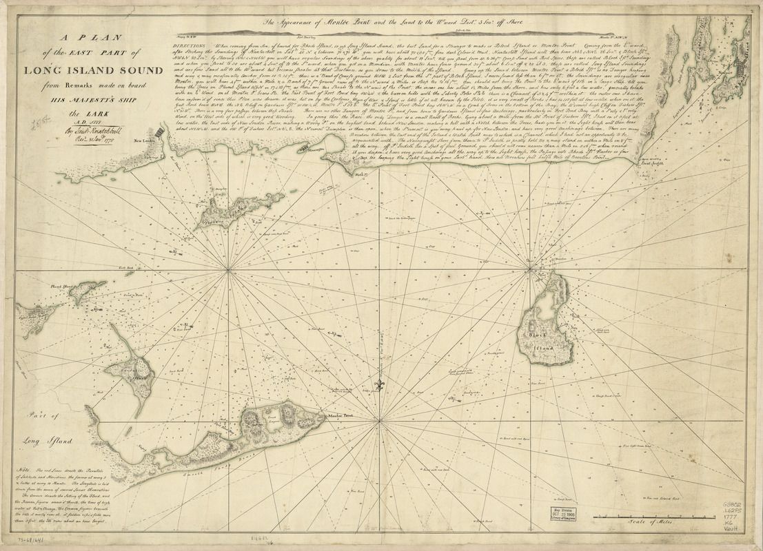
A plan of the east part of Long Island Sound : from remarks made on board His Majesty's ship the Lark, A.D. 1777
This map is also available in American Revolutionary Geographies Online (ARGO), a collections portal especially built for material relating to the American Revolutionary War Era. Visit ARGO to learn more about this item and explore the historical geography of North America in the late eighteenth century.
Item Information
- Title:
- A plan of the east part of Long Island Sound : from remarks made on board His Majesty's ship the Lark, A.D. 1777
- Creator:
- Knatchbull, Charles
- Date:
-
[1777]
- Format:
-
Maps/Atlases
Manuscripts
- Location:
- Library of Congress Geography and Map Division
- Collection (local):
-
Library of Congress Collection
- Subjects:
-
Nautical charts--Long Island Sound (N.Y. and Conn.)--Early works to 1800
Long Island Sound (N.Y. and Conn.)--Maps, Manuscript--Early works to 1800
- Places:
-
Long Island Sound (bay)
- Extent:
- 1 manuscript map : hand color 52 x 75 cm.
- Terms of Use:
-
No known copyright restrictions.
This work is licensed for use under a Creative Commons Attribution Non-Commercial Share Alike License (CC BY-NC-SA).

- Scale:
-
Scale ca. 1:127,000
- Language:
-
English
- Catalog Record:
-
https://lccn.loc.gov/73691641
- Notes:
-
Manuscript, pen-and-ink and watercolor.
Relief shown by hachures. Depths shown by soundings.
LC copy annotated: By Lieutt. Knatchbull, Recd. 31 Jany. 1778.
Includes directions for navigation and profile "The appearance of Montoc Point and the land to the w[es]tward diste. 3 leag. off shore."
- Notes (date):
-
This date is inferred.
- Notes (citation):
-
LC Maps of North America, 1750-1789, 1228
- Identifier:
-
ar122800


