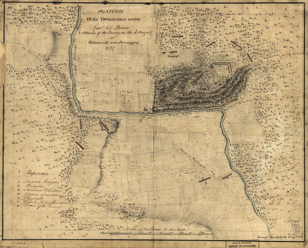
Position of the detachment under Lieut't Col. Baum & attacks of the enemy on the 16th August at Walmscock near Benington, 1777
This map is also available in American Revolutionary Geographies Online (ARGO), a collections portal especially built for material relating to the American Revolutionary War Era. Visit ARGO to learn more about this item and explore the historical geography of North America in the late eighteenth century.
Item Information
- Title:
- Position of the detachment under Lieut't Col. Baum & attacks of the enemy on the 16th August at Walmscock near Benington, 1777
- Title (alt.):
-
Walmscock near Benington
- Creator:
- Durnford, Desmaretz, -1782
- Name on Item:
-
Lieut't Durnford, engineer
- Date:
-
[1777]
- Format:
-
Maps/Atlases
Manuscripts
- Location:
- Library of Congress Geography and Map Division
- Collection (local):
-
Library of Congress Collection
- Subjects:
-
Bennington, Battle of, N.Y., 1777--Maps, Manuscript--Early works to 1800
Walloomsac (N.Y.)--Maps--Early works to 1800
Bennington (Vt.)--Maps--Early works to 1800
- Places:
-
New YorkRensselaer (county)Walloomsac
VermontBennington (county)Bennington
- Extent:
- 1 manuscript map : hand color, 31 x 39 cm.
- Terms of Use:
-
No known copyright restrictions.
This work is licensed for use under a Creative Commons Attribution Non-Commercial Share Alike License (CC BY-NC-SA).

- Scale:
-
Scale ca. 1:6,000
- Language:
-
English
- Catalog Record:
-
https://lccn.loc.gov/gm71000658
- Notes:
-
Manuscript, pen-and-ink and watercolor.
Has watermark.
Oriented with north to the right.
Relief shown by hachures.
Shows troop positions of battle fought in the town of Hoosick, N.Y. in defense of Bennington, Vt.
Includes "References."
- Notes (date):
-
This date is inferred.
- Notes (citation):
-
LC Maps of North America, 1750-1789, 1177
- Identifier:
-
ar117700


