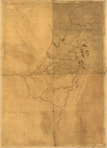
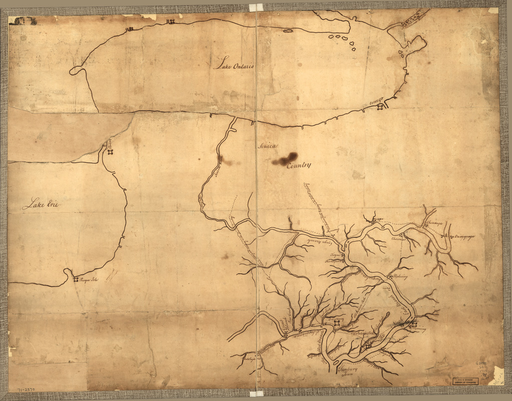
Plan of part of western front
This map is also available in American Revolutionary Geographies Online (ARGO), a collections portal especially built for material relating to the American Revolutionary War Era. Visit ARGO to learn more about this item and explore the historical geography of North America in the late eighteenth century.
Item Information
- Title:
- Plan of part of western front
- Title (alt.):
-
Western Front
- Date:
-
[1778?]
- Format:
-
Maps/Atlases
Manuscripts
- Location:
- Library of Congress Geography and Map Division
- Collection (local):
-
Library of Congress Collection
- Subjects:
-
Susquehanna River Valley--Maps, Manuscript--Early works to 1800
Indians of North America--Pennsylvania--Maps--Early works to 1800
Pennsylvania--Maps, Manuscript--Early works to 1800
- Places:
-
Susquehanna River
Pennsylvania
- Extent:
- 1 manuscript map on sheet 63 x 83 cm.
- Terms of Use:
-
No known copyright restrictions.
This work is licensed for use under a Creative Commons Attribution Non-Commercial Share Alike License (CC BY-NC-SA).

- Scale:
-
Scale ca. 1:600,000
- Language:
-
English
- Catalog Record:
-
https://lccn.loc.gov/gm71002370
- Notes:
-
Manuscript, pen-and-ink.
Title from verso.
Shows northern Pennsylvania and western New York, detailed mapping showing numerous forts, Indian villages, and trails, is restricted to the Susquehanna Valley north of Sunbury Town.
- Notes (citation):
-
LC Maps of North America, 1750-1789, 1051
- Identifier:
-
ar105100z