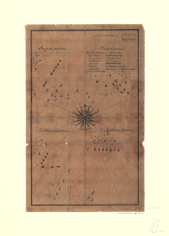
Quatre positions de la flotte française et positions de la flotte anglaise
This map is also available in American Revolutionary Geographies Online (ARGO), a collections portal especially built for material relating to the American Revolutionary War Era. Visit ARGO to learn more about this item and explore the historical geography of North America in the late eighteenth century.
Item Information
- Title:
- Quatre positions de la flotte française et positions de la flotte anglaise
- Date:
-
[1780]
- Format:
-
Maps/Atlases
Manuscripts
- Location:
- Library of Congress Geography and Map Division
- Collection (local):
-
Library of Congress Collection
- Subjects:
-
Rhode Island--History--Revolution, 1775-1783--Maps, Manuscript--Early works to 1800
United States--History--Revolution, 1775-1783--Naval operations--Maps, Manuscript--Early works to 1800
- Places:
-
Rhode Island
- Extent:
- 1 manuscript map : hand color 36 x 22 cm.
- Terms of Use:
-
No known copyright restrictions.
This work is licensed for use under a Creative Commons Attribution Non-Commercial Share Alike License (CC BY-NC-SA).

- Scale:
-
Scale not given
- Language:
-
French
- Catalog Record:
-
https://lccn.loc.gov/gm71002160
- Notes:
-
Title from manuscript label on verso as originally mounted.
Manuscript, pen-and-ink and watercolor.
- Notes (date):
-
This date is inferred.
- Notes (citation):
-
LC Maps of North America, 1750-1789, 1021
- Identifier:
-
ar102100