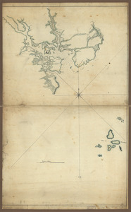
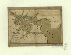
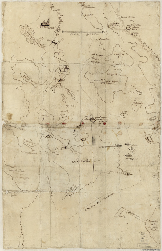
Portsmouth, New Hampshire
This map is also available in American Revolutionary Geographies Online (ARGO), a collections portal especially built for material relating to the American Revolutionary War Era. Visit ARGO to learn more about this item and explore the historical geography of North America in the late eighteenth century.
Item Information
- Title:
- Portsmouth, New Hampshire
- Date:
-
[1782?]
- Format:
-
Maps/Atlases
Manuscripts
- Location:
- Library of Congress Geography and Map Division
- Collection (local):
-
Library of Congress Collection
- Subjects:
-
Portsmouth (N.H.)--History--Revolution, 1775-1783--Maps, Manuscript--Early works to 1800
Harbors--New Hampshire--Portsmouth--Maps--Early works to 1800
- Places:
-
Rockingham (county)Portsmouth
- Extent:
- 1 manuscript map on sheet 72 x 46 cm.
- Terms of Use:
-
No known copyright restrictions.
This work is licensed for use under a Creative Commons Attribution Non-Commercial Share Alike License (CC BY-NC-SA).

- Scale:
-
Scale ca. 1:61,000
- Language:
-
French
- Catalog Record:
-
https://lccn.loc.gov/gm71000982
- Notes:
-
Title from verso.
Alternate title from Philip Lee Phillips A list of maps of America: Croquis de la rade de Portsmouth; position de la flotte française.
Manuscript, pen-and-ink.
Has watermarks.
Oriented with north to the right.
Shows Portsmouth harbor, including fortifications on shore and position of the French ships "Pluton," "Auguste," and "Bourgogne."
- Notes (citation):
-
LC Maps of North America, 1750-1789, 876
- Identifier:
-
ar087600