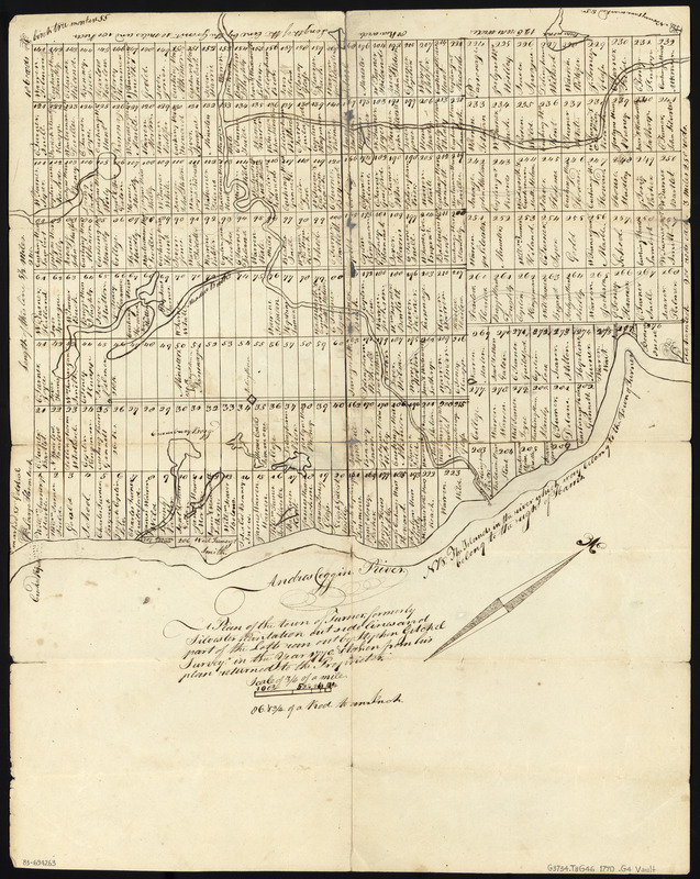
Plan of the Town of Turner, formerly Silvester Plantation : out side lines and part of the lotts ran out
This map is also available in American Revolutionary Geographies Online (ARGO), a collections portal especially built for material relating to the American Revolutionary War Era. Visit ARGO to learn more about this item and explore the historical geography of North America in the late eighteenth century.
Item Information
- Title:
- Plan of the Town of Turner, formerly Silvester Plantation : out side lines and part of the lotts ran out
- Creator:
- Getchel, Stephen
- Name on Item:
-
by Stephen Getchel survey'r in the year 1770 & taken from his plan returned to the Proprietor
- Date:
-
1770
- Format:
-
Maps/Atlases
Manuscripts
- Location:
- Library of Congress Geography and Map Division
- Collection (local):
-
Library of Congress Collection
- Subjects:
-
Real property--Maine--Turner (Town)--Maps--Early works to 1800
Turner (Me. : Town)--Maps, Manuscript--Early works to 1800
Manuscript maps--Early works to 1800
- Places:
-
Androscoggin (county)Turner
- Extent:
- 1 map : ms. ; 46 x 37 cm., folded to 19 x 12 cm.
- Terms of Use:
-
No known copyright restrictions.
This work is licensed for use under a Creative Commons Attribution Non-Commercial Share Alike License (CC BY-NC-SA).

- Scale:
-
Scale [1:31,680]
- Language:
-
English
- Catalog Record:
-
https://lccn.loc.gov/83694263
- Notes:
-
Shows lot numbers and lot holder's names.
Pen-and-ink and pencil.
Oriented with north toward the upper right.
Includes note.
Panel title: A plan of the Town of Turner.
Unidentified numbers of verso.
- Identifier:
-
ct004067


