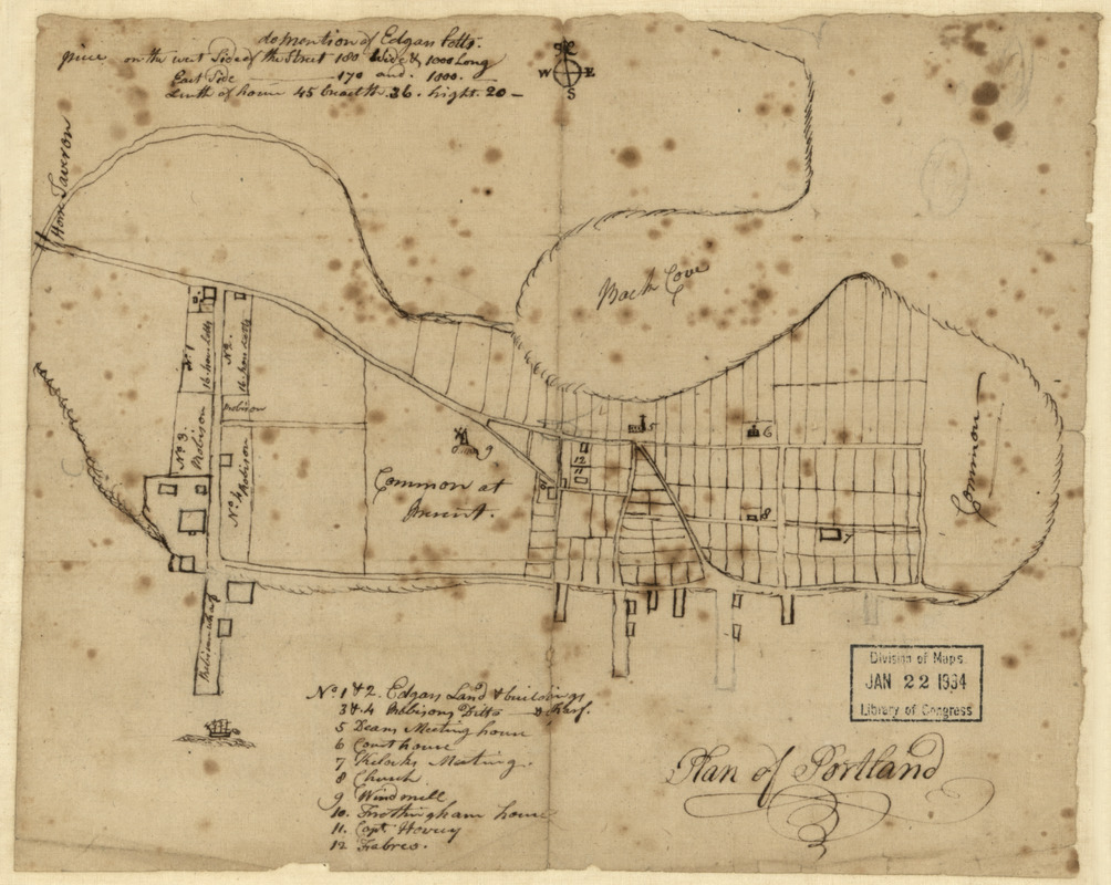
Plan of Portland
This map is also available in American Revolutionary Geographies Online (ARGO), a collections portal especially built for material relating to the American Revolutionary War Era. Visit ARGO to learn more about this item and explore the historical geography of North America in the late eighteenth century.
Item Information
- Title:
- Plan of Portland
- Date:
-
[1800–1899]
- Format:
-
Maps/Atlases
Manuscripts
- Location:
- Library of Congress Geography and Map Division
- Collection (local):
-
Library of Congress Collection
- Subjects:
-
Real property--Maine--Portland--Maps
Landowners--Maine--Portland--Maps
- Places:
-
Cumberland (county)Portland
- Extent:
- 1 ms. map ; on sheet 20 x 24 cm.
- Terms of Use:
-
No known copyright restrictions.
This work is licensed for use under a Creative Commons Attribution Non-Commercial Share Alike License (CC BY-NC-SA).

- Scale:
-
Scale not given
- Language:
-
English
- Catalog Record:
-
https://lccn.loc.gov/2011589244
- Notes:
-
Cadastral map of Portland, Maine, that shows lot lines, some lot numbers, and some names of landowners.
Pen-and-ink.
Includes index of selected buildings and note on property of Edgar Potts.
Imperfect: Brittle, creased, torn, stained, darkened, annotated on verso in pencil, mounted on cloth backing.
- Notes (date):
-
This date is inferred.
- Identifier:
-
la002044


