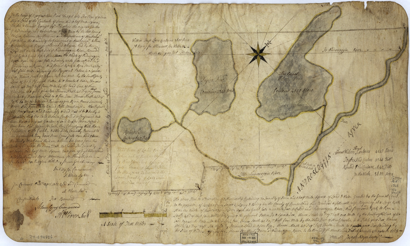
The above plan is a discription of a new township containing the quantity of seven and a half mile of land & water, granted by the General Court to the proprietors of Bakerstown : so call'd, lying & being in the county of Cumberland ... Deld. at Falmouth, 4th September 1765
This map is also available in American Revolutionary Geographies Online (ARGO), a collections portal especially built for material relating to the American Revolutionary War Era. Visit ARGO to learn more about this item and explore the historical geography of North America in the late eighteenth century.
Item Information
- Title:
- The above plan is a discription of a new township containing the quantity of seven and a half mile of land & water, granted by the General Court to the proprietors of Bakerstown : so call'd, lying & being in the county of Cumberland ... Deld. at Falmouth, 4th September 1765
- Creator:
- Noyes, Joseph, 1740-1795
- Name on Item:
-
Attest. Joseph Noyes, surveyr.
- Date:
-
[1765]
- Format:
-
Maps/Atlases
Manuscripts
- Location:
- Library of Congress Geography and Map Division
- Collection (local):
-
Library of Congress Collection
- Subjects:
-
Auburn (Me.)--Maps, Manuscript--Early works to 1800
- Places:
-
Androscoggin (county)Auburn
- Extent:
- 1 manuscript map : hand color on sheet 41 x 68 cm.
- Terms of Use:
-
No known copyright restrictions.
This work is licensed for use under a Creative Commons Attribution Non-Commercial Share Alike License (CC BY-NC-SA).

- Scale:
-
Scale ca. 1:43,000
- Language:
-
English
- Catalog Record:
-
https://lccn.loc.gov/74694806
- Notes:
-
Manuscript, pen-and-ink and watercolor.
Oriented with north toward the upper right.
"A true copy compared, A. Oliver, sect."
Includes text.
- Notes (date):
-
This date is inferred.
- Notes (citation):
-
LC Maps of North America, 1750-1789, 833
- Identifier:
-
ar083300


