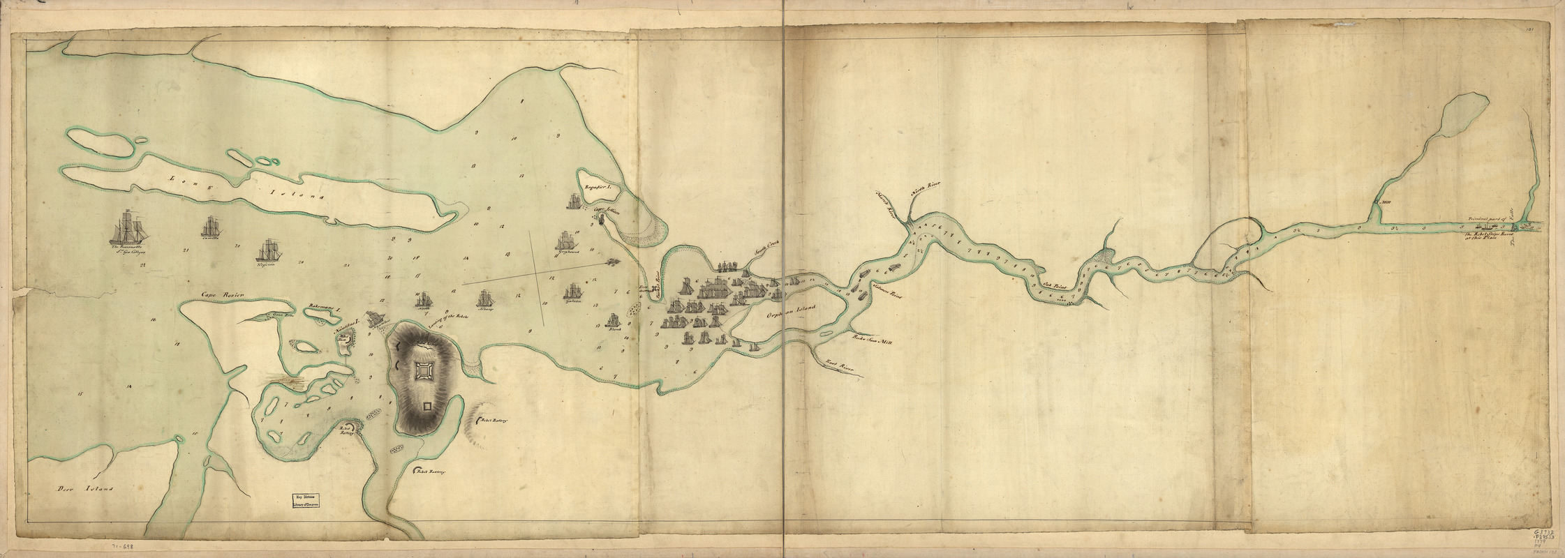
Penobscot River and Bay, with the operations of the English fleet, under Sir George Collyer : against the division of Massachusetts troops acting against Fort Castine, August 1779; with full soundings up to the present site of Bangor
This map is also available in American Revolutionary Geographies Online (ARGO), a collections portal especially built for material relating to the American Revolutionary War Era. Visit ARGO to learn more about this item and explore the historical geography of North America in the late eighteenth century.
Item Information
- Title:
- Penobscot River and Bay, with the operations of the English fleet, under Sir George Collyer : against the division of Massachusetts troops acting against Fort Castine, August 1779; with full soundings up to the present site of Bangor
- Title (alt.):
-
Fort Castine
- Date:
-
[1779?]
- Format:
-
Maps/Atlases
Manuscripts
- Location:
- Library of Congress Geography and Map Division
- Collection (local):
-
Library of Congress Collection
- Subjects:
-
Penobscot Expedition, 1779--Maps, Manuscript--Early works to 1800
Penobscot Bay Region (Me.)--Defenses--Maps, Manuscript--Early works to 1800
- Places:
-
MainePenobscot (bay)
- Extent:
- 1 manuscript map : hand color 46 x 146 cm.
- Terms of Use:
-
No known copyright restrictions.
This work is licensed for use under a Creative Commons Attribution Non-Commercial Share Alike License (CC BY-NC-SA).

- Scale:
-
Scale ca. 1:46,000
- Language:
-
English
- Catalog Record:
-
https://lccn.loc.gov/gm71000698
- Notes:
-
Title from William Faden's Catalogue of a curious and valuable collection of original maps and plans.
Manuscript, pen-and-ink and watercolor.
Has watermarks.
Oriented with north to the right.
Relief shown by shading. Depths shown by soundings.
- Notes (citation):
-
LC Maps of North America, 1750-1789, 840
- Identifier:
-
ar084000z


