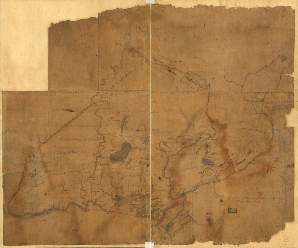
A Plan of the late Province of Main as far as Kennebeck River
This map is also available in American Revolutionary Geographies Online (ARGO), a collections portal especially built for material relating to the American Revolutionary War Era. Visit ARGO to learn more about this item and explore the historical geography of North America in the late eighteenth century.
Item Information
- Title:
- A Plan of the late Province of Main as far as Kennebeck River
- Title (alt.):
-
Backers Town
- Date:
-
[1778?]
- Format:
-
Maps/Atlases
Manuscripts
- Location:
- Library of Congress Geography and Map Division
- Collection (local):
-
Library of Congress Collection
- Subjects:
-
Maine--Maps, Manuscript--Early works to 1800
Maine--Administrative and political divisions--Maps--Early works to 1800
- Places:
-
Maine
- Extent:
- 1 manuscript map : hand color on sheet 87 x 104 cm.
- Terms of Use:
-
No known copyright restrictions.
This work is licensed for use under a Creative Commons Attribution Non-Commercial Share Alike License (CC BY-NC-SA).

- Scale:
-
Scale ca. 1:200,000
- Language:
-
English
- Catalog Record:
-
https://lccn.loc.gov/74692577
- Notes:
-
Manuscript, pen-and-ink and watercolor.
Imperfect: Margin deteriorated and a section of the upper left corner missing.
In 2 sections, mounted on cloth backing.
Oriented with north toward the upper right.
Shows internal boundaries.
Accompanied by positive photocopy of verso, taken prior to mounting, showing "Backers Town."
- Notes (citation):
-
LC Maps of North America, 1750-1789, 836
- Identifier:
-
ar083600z


![[A map of part of New York, comprehending the country between New York and Quebec, the river Connecticut, &c., to shew "the way from Albany to Canada ..... part by land and part by water;" drawn about 1720, on a scale of 31 miles to an inch]](https://bpldcassets.blob.core.windows.net/derivatives/images/commonwealth:6108vw070/image_thumbnail_300.jpg)
