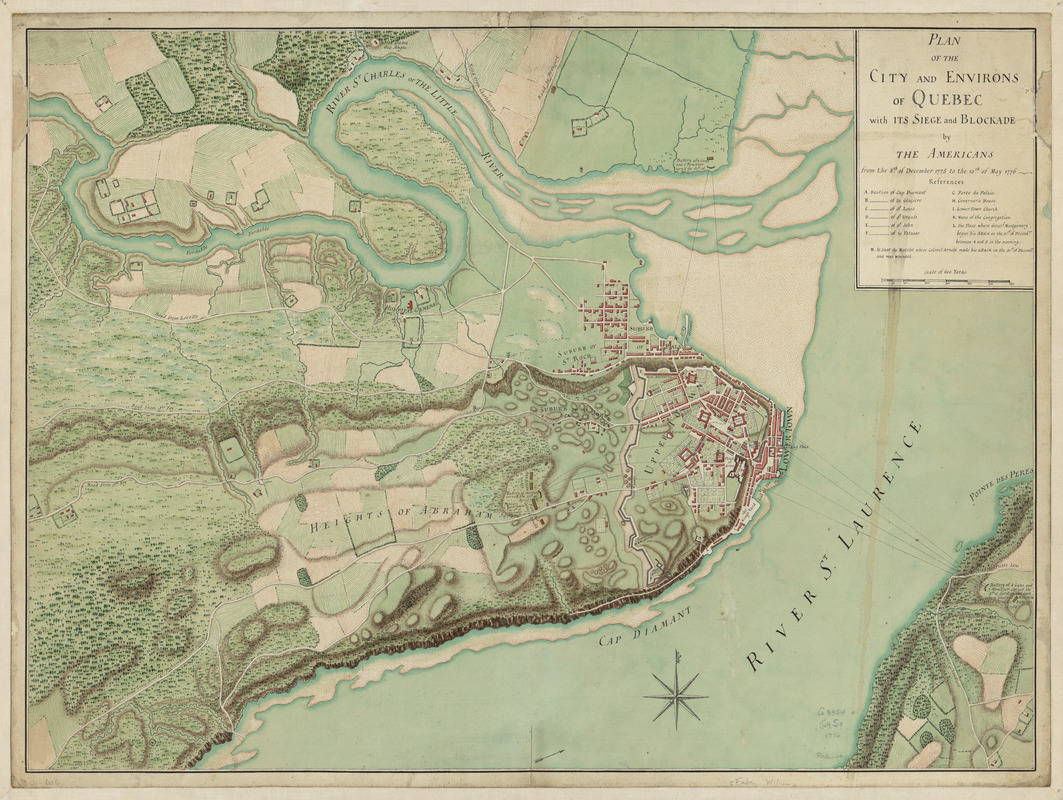
Plan of the city and environs of Quebec, with its siege and blockade by the Americans : from the 8th of December, 1775 to the 13th of May, 1776
This map is also available in American Revolutionary Geographies Online (ARGO), a collections portal especially built for material relating to the American Revolutionary War Era. Visit ARGO to learn more about this item and explore the historical geography of North America in the late eighteenth century.
Item Information
- Title:
- Plan of the city and environs of Quebec, with its siege and blockade by the Americans : from the 8th of December, 1775 to the 13th of May, 1776
- Date:
-
[1776]
- Format:
-
Maps/Atlases
Manuscripts
- Location:
- Library of Congress Geography and Map Division
- Collection (local):
-
Library of Congress Collection
- Subjects:
-
Québec (Québec)--History--Siege, 1775-1776--Maps, Manuscript--Early works to 1800
- Places:
-
CanadaQuébec
- Extent:
- 1 manuscript map : hand color 46 x 63 cm.
- Terms of Use:
-
No known copyright restrictions.
This work is licensed for use under a Creative Commons Attribution Non-Commercial Share Alike License (CC BY-NC-SA).

- Scale:
-
Scale ca. 1:6,900
- Language:
-
English
- Catalog Record:
-
https://lccn.loc.gov/gm71000606
- Notes:
-
Manuscript, pen-and-ink and watercolor.
Relief shown by hachures.
Includes historic notes and index to important buildings and military defenses.
- Notes (date):
-
This date is inferred.
- Notes (citation):
-
LC Maps of North America, 1750-1789, 611
- Identifier:
-
ar061100


