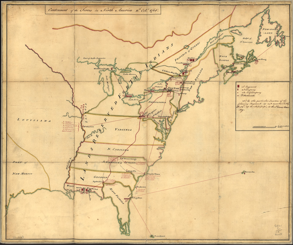
Cantonment of the forces in North America 11th. Octr. 1765
This map is also available in American Revolutionary Geographies Online (ARGO), a collections portal especially built for material relating to the American Revolutionary War Era. Visit ARGO to learn more about this item and explore the historical geography of North America in the late eighteenth century.
Item Information
- Title:
- Cantonment of the forces in North America 11th. Octr. 1765
- Date:
-
[1765]
- Format:
-
Maps/Atlases
Manuscripts
- Location:
- Library of Congress Geography and Map Division
- Collection (local):
-
Library of Congress Collection
- Subjects:
-
Military bases--North America--Maps
Manuscript maps--Early works to 1800
North America--Defenses--Maps, Manuscript--Early works to 1800
- Places:
-
North America (area)
- Extent:
- 1 manuscript map : hand color 50 x 61 cm.
- Terms of Use:
-
No known copyright restrictions.
This work is licensed for use under a Creative Commons Attribution Non-Commercial Share Alike License (CC BY-NC-SA).

- Scale:
-
Scale ca. 1:6,500,000
- Language:
-
English
- Catalog Record:
-
https://lccn.loc.gov/gm72002043
- Notes:
-
Manuscript, pen-and-ink and watercolor.
Shows size of cantonments.
"N.B. The particular quarters of the following regiments is not ascertain'd, viz. the 34th up the Mississipi, in the Illinois country."
- Notes (date):
-
This date is inferred.
- Notes (citation):
-
LC Maps of North America, 1750-1789, 114
- Identifier:
-
ar011400


