Atlas of the city of Boston, West Roxbury : plate 12
Item Information
- Title:
- Atlas of the city of Boston, West Roxbury : plate 12
- Description:
-
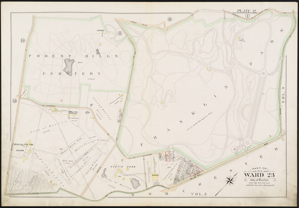
Just east of the Arnold Arboretum is Franklin Park, a 485-acre expanse that became part of the park system in 1885. Envisioned by Frederick Law Olmsted as a restful space for Bostonians to recuperate from the stresses of city life, Franklin Park was the place where nature and health met.As this 1896 map illustrates, the park was designed to appeal to a diverse community with designated spaces for quiet repose, as well as those for more invigorating activities such as athletics. However, at the request of citizens, this quiet country park eventually included more stimulating forms of entertainment.
- Creator:
- Bromley, George Washington
- Creator:
- Bromley, Walter Scott
- Date:
-
1896
- Format:
-
Maps/Atlases
- Location:
-
Boston Public Library
Norman B. Leventhal Map Center - Collection (local):
-
Norman B. Leventhal Map Center Collection
- Subjects:
-
Boston (Mass.)--Maps
Real property--Massachusetts--Boston--Maps
Landowners--Massachusetts--Boston--Maps
Roxbury (Boston, Mass.)--Maps
- Places:
-
MassachusettsSuffolk (county)BostonRoxbury
MassachusettsSuffolk (county)BostonWest Roxbury
- Extent:
- 1 map : color ; 51 x 77 cm
- Terms of Use:
-
No known copyright restrictions.
No known restrictions on use.
- Publisher:
-
Philadelphia :
G.W. Bromley & Co.
- Scale:
-
Scale 1:3,600
- Language:
-
English
- Notes (exhibitions):
-
Exhibited: "Boston in the Gilded Age: Mapping Public Places" organized by the Norman B. Leventhal Map Center at the Boston Public Library, 2012-2013.
- Identifier:
-
06_01_013068
- Call #:
-
G1234.B6 B7 1896
- Barcode:
-
39999059011278


