Atlas of the city of Boston : city proper : plate 32
Item Information
- Title:
- Atlas of the city of Boston : city proper : plate 32
- Description:
-
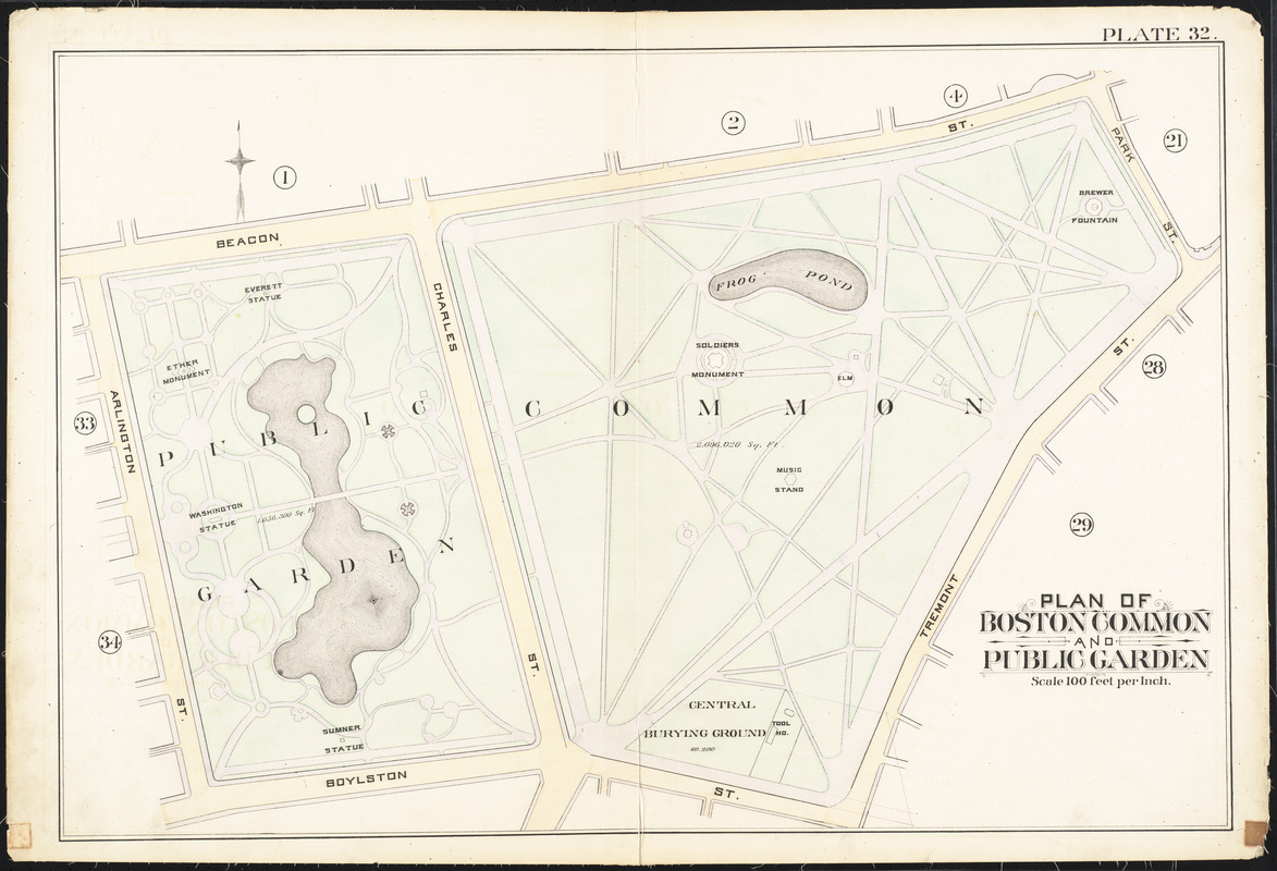
The story of Boston’s park system begins at the Boston Common – the oldest park in the country. This 50 acre pastoral expanse was originally used for grazing cattle, and was converted to park space in the early 1800s. Abutting the Common is the Public Garden – America’s first public botanical park. Completed in 1860, it was Boston’s answer to Central Park. Intended to encourage leisurely strolls while taking in the exotic plant-life, the Garden serves as the gateway to a vast network of green spaces throughout the city.
- Creator:
- Bromley, George Washington
- Creator:
- Bromley, Walter Scott
- Date:
-
1888
- Format:
-
Maps/Atlases
- Location:
-
Boston Public Library
Norman B. Leventhal Map Center - Collection (local):
-
Norman B. Leventhal Map Center Collection
- Subjects:
-
Boston (Mass.)--Maps
Real property--Massachusetts--Boston--Maps
Landowners--Massachusetts--Boston--Maps
Beacon Hill (Boston, Mass.)--Maps
- Places:
-
MassachusettsSuffolk (county)BostonBeacon Hill
- Extent:
- 1 map : color ; 51 x 77 cm
- Terms of Use:
-
No known copyright restrictions.
No known restrictions on use.
- Publisher:
-
Philadelphia :
G.W. Bromley & Co.
- Scale:
-
Scale 1:1,200
- Language:
-
English
- Notes (exhibitions):
-
Exhibited: "Torn in Two: The 150th Anniversary of the Civil War" organized by the Norman B. Leventhal Map Center at the Boston Public Library, 2011.
Exhibited: "Boston in the Gilded Age: Mapping Public Places" organized by the Norman B. Leventhal Map Center at the Boston Public Library, 2012-2013.
- Identifier:
-
06_01_012818
- Call #:
-
G1234.B6 B7 1888 v.1
- Barcode:
-
39999059011096
![[Plan of lots between Mount Vernon and Pinckney Streets in Boston]](https://bpldcassets.blob.core.windows.net/derivatives/images/commonwealth:9s161h42m/image_thumbnail_300.jpg)


