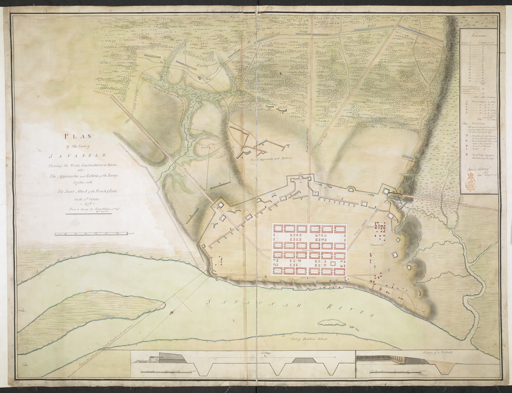
PLAN Of the Town of SAVANNAH, Showing the Works Constructed for its Defence; also, The Approaches and Batteries of the Enemy: Together with The Joint Attack of the French & Rebels on the 9th October 1779
This map is also available in American Revolutionary Geographies Online (ARGO), a collections portal especially built for material relating to the American Revolutionary War Era. Visit ARGO to learn more about this item and explore the historical geography of North America in the late eighteenth century.
Item Information
- Title:
- PLAN Of the Town of SAVANNAH, Showing the Works Constructed for its Defence; also, The Approaches and Batteries of the Enemy: Together with The Joint Attack of the French & Rebels on the 9th October 1779
- Cartographer:
- Moncrief, James, 1744-1793
- Surveyor:
- Wilson, John, 1755-1798
- Former owner:
- Amherst, Jeffery Amherst, Baron, 1717-1797
- Former owner:
- Royal United Services Institute for Defence and Security Studies
- Name on Item:
-
From a Survey by John Wilson 71.st Reg.t Ass.t Engineer.
- Date:
-
[1779]
- Format:
-
Maps/Atlases
- Location:
- British Library
- Collection (local):
-
British Library Collection
- Subjects:
-
Military art and science--Georgia--Savannah--Maps, Manuscript--Early works to 1800
Fortification--Georgia--Savannah--Maps, Manuscript--Early works to 1800
Savannah (Ga.)--Maps, Manuscript--Early works to 1800
Savannah (Ga.)--History--Siege, 1779--Maps, Manuscript--Early works to 1800
- Places:
-
Chatham (county)Savannah
- Extent:
- 1 map on 2 sheets : joined, manuscript pen and ink with watercolour over pencil ; 73 x 96 cm
- Terms of Use:
-
No known copyright restrictions.
This work is licensed for use under a Creative Commons Attribution Non-Commercial Share Alike License (CC BY-NC-SA).

- Publisher:
-
[Place of production not identified] :
From a Survey by John Wilson 71.st Reg.t Ass.t Engineer,
- Scale:
-
Scale approximately 1:4,400
- Language:
-
English
- Catalog Record:
-
http://searcharchives.bl.uk/IAMS_VU2:IAMS040-001999749
- Notes:
-
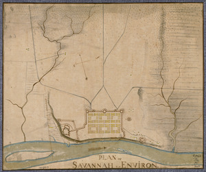
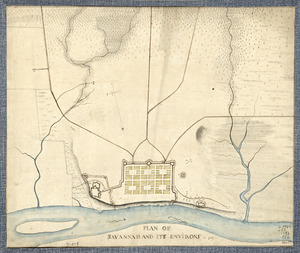
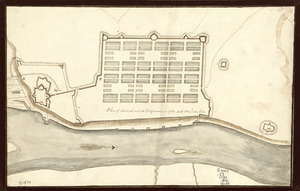
Relief is shown by shading and by hachuring
North is oriented to the bottom of the map and is indicated by a decoratice compass arroow in the Savannah river
Shows title at centre left with scale bar in yards beneath
Shows extensive key at upper right identifying fortifications around the town. They key is signed "James Moncrief Com.d Engineer"
Shows two sections through the fortifications at the bottom of the map with their own scale of feet (scale approximately 1:120)
Shows grid sytem in pencil over map
Compare "Plan of the town of Savannah, with the works constructed for its defence, together with the approaches & batteries of the enemy, and the joint attack of the French and rebels on the 9th of October, 1779 : From a survey / by John Wilson 71st Regt., asst. engineer" held by the William L. Clements (Maps 5-D-6).
Copy at Add Ms 27,716.3. Red stamp of R.U.S.I. in key. Laid on linen. Green circular label to verso showing "44". White label to verso showing "DRAWER 30 SECTION 1". Blue label to verso showing "A 30/67". Stamped in black ink "ADD. MS. 57,716(3)". Manuscript addition to verso in pencil "AWI 134".
Exhibited: The American War of Independence 1775-83. A commemorative exhibition organized by the Map Library and the Department of Manscuscripts of the British Library Reference Division 4 July to 11 November 1975
- Notes (date):
-
9999
This date is inferred.

![[Map of the operations at the seige of Savannah in 1779, by the French and American forces]](https://bpldcassets.blob.core.windows.net/derivatives/images/commonwealth:9s161g724/image_thumbnail_300.jpg)