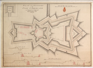
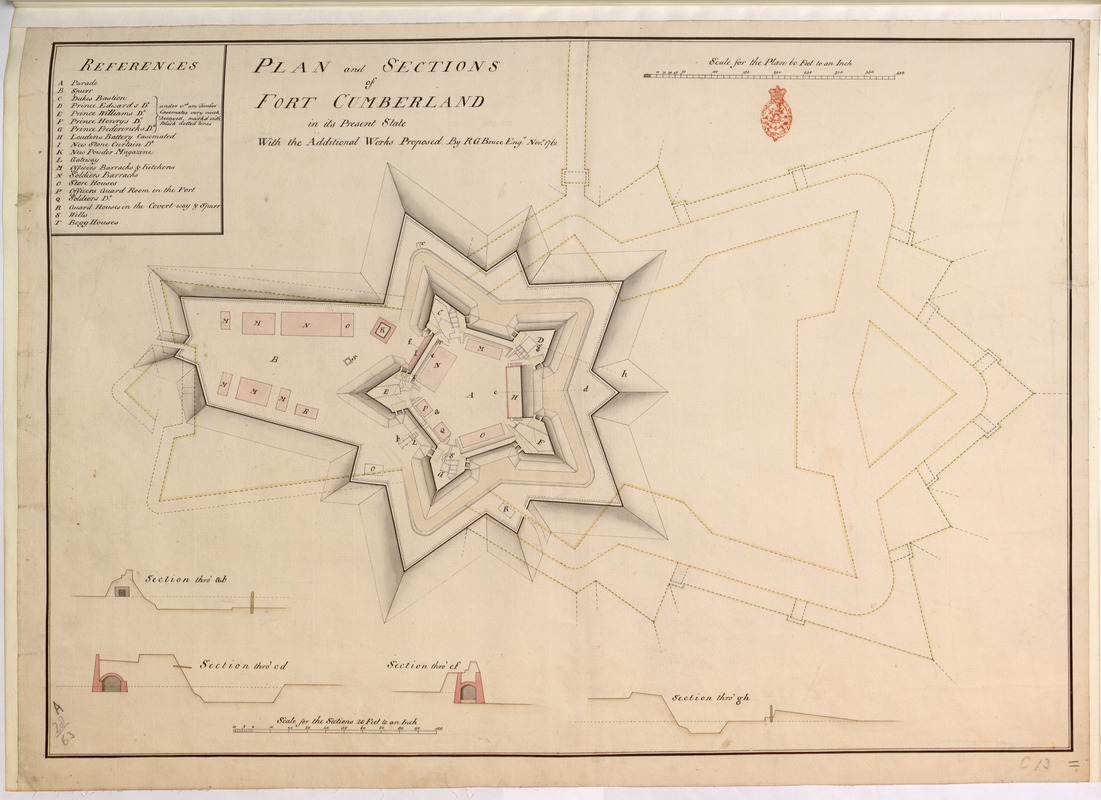
PLAN and SECTIONS of FORT CUMBERLAND in its Present State With the Additional Works Proposed
This map is also available in American Revolutionary Geographies Online (ARGO), a collections portal especially built for material relating to the American Revolutionary War Era. Visit ARGO to learn more about this item and explore the historical geography of North America in the late eighteenth century.
Item Information
- Title:
- PLAN and SECTIONS of FORT CUMBERLAND in its Present State With the Additional Works Proposed
- Cartographer:
- Bruce, Robert George
- Former owner:
- Amherst, Jeffery Amherst, Baron, 1717-1797
- Former owner:
- Royal United Services Institute for Defence and Security Studies
- Name on Item:
-
By R G Bruce Eng.r Nov.r 1761.
- Date:
-
1761
- Format:
-
Maps/Atlases
- Location:
- British Library
- Collection (local):
-
British Library Collection
- Subjects:
-
Fortification--New Brunswick--Fort Cumberland--Maps, Manuscript--Early works to 1800
Military art and science--New Brunswick--Fort Cumberland--Maps, Manuscript--Early works to 1800
Fort Cumberland (N.B.)--Maps, Manuscript--Early works to 1800
- Places:
-
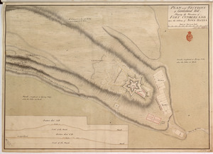
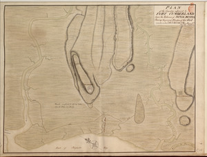
CanadaFort Beauséjour National Historic Park (historical park)
- Extent:
- 1 map : manuscript pen and ink with watercolour ; 50 x 72 cm
- Terms of Use:
-
No known copyright restrictions.
This work is licensed for use under a Creative Commons Attribution Non-Commercial Share Alike License (CC BY-NC-SA).

- Publisher:
-
[Fort Cumberland?] :
R G Bruce,
- Scale:
-
Scale approximately 1:720
- Language:
-
English
- Catalog Record:
-
http://searcharchives.bl.uk/IAMS_VU2:IAMS040-001999731
- Notes:
-
Shows title at upper left.
Shows "Scale for the Plan 60 Feet to an Inch" at upper right.
Shows a lettered (A-T) table of references (key) at upper left. The key names bastions and identifies locations within the fort.
Proposed works are shown in yellow.
Shows four sections through the fort at the bottom of the map with a "Scale for the Sections 20 feet to an Inch" (1:240).
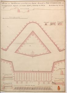
Compare other manuscript maps of Fort Cumberland by Robert George Bruce in R.U.S.I. Vol LXVI.
Copy at Add Ms 57,701.11. Bound in R.U.S.I. Vol LXVI. Shows the red stamp of R.U.S.I. beneath the scale bar at upper right. Shows manuscript addition of "11" in pencil at lower right, "C13" also at lower right and "A 28/63" at lower left. Laid on linen. Green circular sticker to verso with "6". Additional white label to verso showing "DRAWER 28 SECTION 1". Additional blue label to verso showing "A 28/63". Paper watermark shows fleur de lys with "LVG" beneath.
- Notes (date):
-
9999