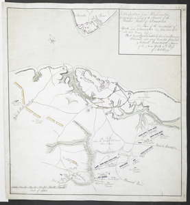
[Map showing the attack of the French upon York in Virginia, June 1782]
![[Map showing the attack of the French upon York in Virginia, June 1782]](https://bpldcassets.blob.core.windows.net/derivatives/images/commonwealth:hx11xz51j/image_access_800.jpg)
This map is also available in American Revolutionary Geographies Online (ARGO), a collections portal especially built for material relating to the American Revolutionary War Era. Visit ARGO to learn more about this item and explore the historical geography of North America in the late eighteenth century.
Item Information
- Title:
- [Map showing the attack of the French upon York in Virginia, June 1782]
- Cartographer:
- Hayman, John
- Date:
-
[1782]
- Format:
-
Maps/Atlases
- Location:
- British Library
- Collection (local):
-
British Library Collection
- Subjects:
-
Military art and science--Virginia--Yorktown--Maps, Manuscript--Early works to 1800
Yorktown (Va.)--History--Siege, 1781--Maps, Manuscript--Early works to 1800
- Places:
-
York (county)Yorktown
- Extent:
- 1 map : manuscript pen and ink ; 51 x 61 cm
- Terms of Use:
-
No known copyright restrictions.
This work is licensed for use under a Creative Commons Attribution Non-Commercial Share Alike License (CC BY-NC-SA).

- Publisher:
-
[Juliana] :
Juliana 12.th June 1782. Copy. John Hayman Lieu.t 17.th Inf.nt,
- Scale:
-
Scale not given
- Language:
-
English
- Catalog Record:
-
http://searcharchives.bl.uk/IAMS_VU2:IAMS032-002087309
- Notes:
-
Title from previous British Library cataloguing.
Relief shown by shading.
Shows position of the troops at the Battle of Yorktown.
Includes a detailed key to the right of the map.
John Hayman signs the map at lower right and states "Copy". His "imprint" seems to suggest Juliana as place of production.
Reproduction in: Hulbert, Archer Butler. The Crown Collection of photographs of American maps. Series 2.
Copy at Add Ms 15,535.6. Small red stamp of British Museum to verso and pressmark repeated in pencil.
- Notes (date):
-
9999
This date is inferred.

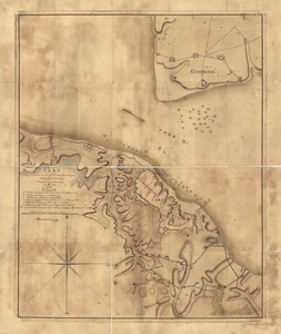
![[French Plan of York Town Virginia]](https://bpldcassets.blob.core.windows.net/derivatives/images/commonwealth:hx11z256q/image_thumbnail_300.jpg)