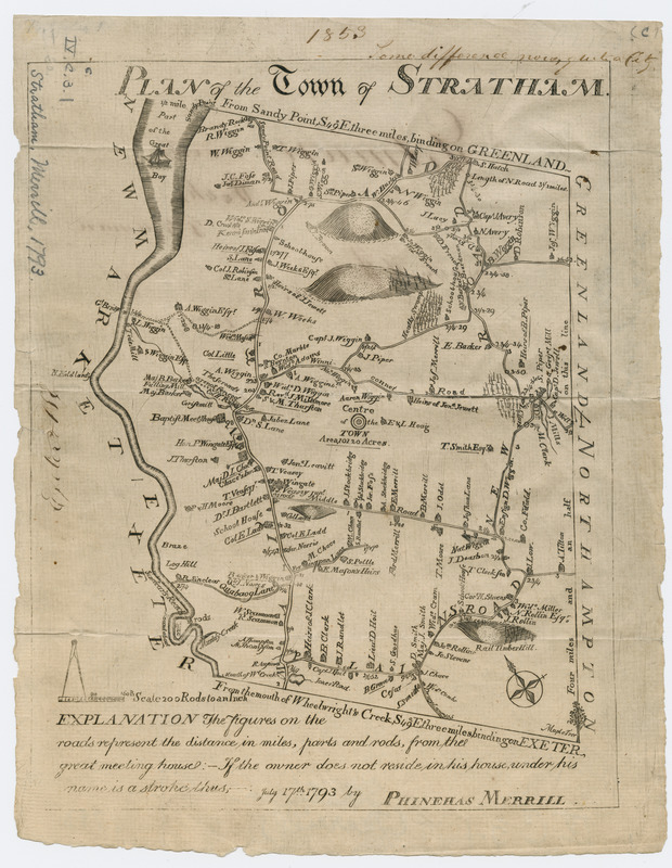
Plan of the town of Stratham
This map is also available in American Revolutionary Geographies Online (ARGO), a collections portal especially built for material relating to the American Revolutionary War Era. Visit ARGO to learn more about this item and explore the historical geography of North America in the late eighteenth century.
Item Information
- Title:
- Plan of the town of Stratham
- Creator:
- Merrill, Phinehas, 1767-1815
- Name on Item:
-
July 17th 1793 by Phinehas Merrill.
- Date:
-
[1793]
- Format:
-
Maps/Atlases
- Location:
- Massachusetts Historical Society
- Collection (local):
-
Massachusetts Historical Society Collection
- Subjects:
-
Stratham (N.H.)--Maps
- Places:
-
Rockingham (county)Stratham
- Extent:
- 1 map ; 24 x 19 cm.
- Terms of Use:
-
No known copyright restrictions.
This work is licensed for use under a Creative Commons Attribution Non-Commercial Share Alike License (CC BY-NC-SA).

- Publisher:
-
[S.l.] :
[s.n.]
- Scale:
-
Scale [1:39,600]
- Language:
-
English
- Catalog Record:
-
http://balthazaar.masshist.org/cgi-bin/Pwebrecon.cgi?DB=local&BBID=186169
- Notes:
-
Relief shown pictorially.
Shows buildings and householders' names.
- Notes (date):
-
This date is inferred.
- LCCN:
-
97683083


