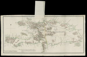
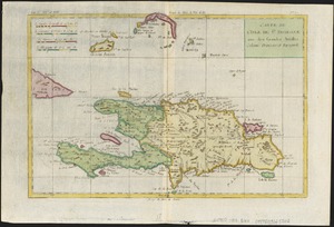
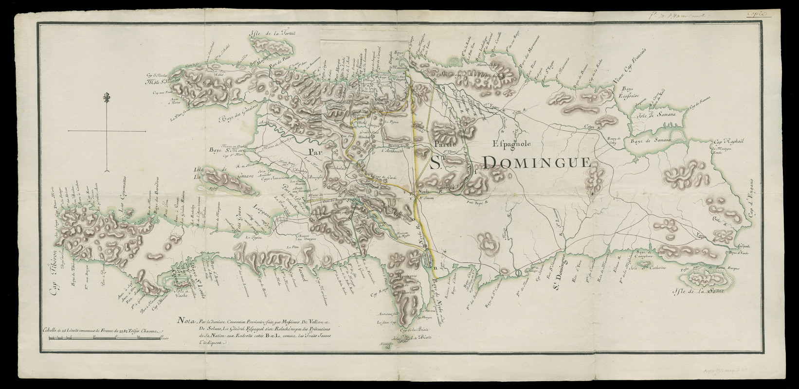
I. de St. Domingue
This map is also available in American Revolutionary Geographies Online (ARGO), a collections portal especially built for material relating to the American Revolutionary War Era. Visit ARGO to learn more about this item and explore the historical geography of North America in the late eighteenth century.
Item Information
- Title:
- I. de St. Domingue
- Title (alt.):
-
Isle de Saint Domingue
- Description:
-
Shows proposed boundary changes on Hispaniola between the French and Spanish colonies of Saint-Domingue (officially the Republic of Haiti since 1804) and Santo Domingo (officially the Dominican Republic since 1844). Includes paste-on flap (191 x 111 mm.) showing alternate boundary in the north central part of the island and note at bottom referring to treaty negotiators and Governors Valliere and De Solano.
- Contributor:
- Hamecourt, P. M. d', fl. 1772
- Date:
-
[1772?]
- Format:
-
Maps/Atlases
Manuscripts
- Location:
- Newberry Library
- Collection (local):
-
Edward E. Ayer Manuscript Map Collection
- Subjects:
-
Manuscript maps--Early works to 1800
Hispaniola--Maps--Early works to 1800
Haiti--Maps--Early works to 1800
Dominican Republic--Maps--Early works to 1800
- Places:
-
Haiti
Dominican Republic
Hispaniola (island)
- Extent:
- 1 ms. map : hand col. ; 368 x 813 mm.
- Terms of Use:
-
No known copyright restrictions.
Contact host institution for more information.
- Scale:
-
Scale [ca. 1:874,000
- Language:
-
French
- Catalog Record:
-
https://i-share-nby.primo.exlibrisgroup.com/permalink/01CARLI_NBY/i5mcb2/alma991462648805867
- Notes:
-
Title from oversize lettering on island.
Ms. note in upper right margin: P. [?] M. d'Hamecourt. Copie.
Related to manuscript maps dated 1772 in Spain's Biblioteca Nacional (number M 2 V.303) and Archivo Histórico Nacional (number unknown). See E. Rodriíguez Demorizi and P.J. Santiago, Mapas y planos de Santo Domingo (Santo Domingo, R.D.: Editora Domingo, 1979) p. 161, plate 76.
Relief shown by shading.
Pen-and-ink and watercolor (brown, green, yellow).
- Call #:
-
Ayer MS map 230