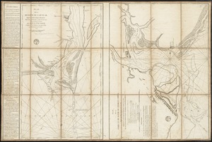
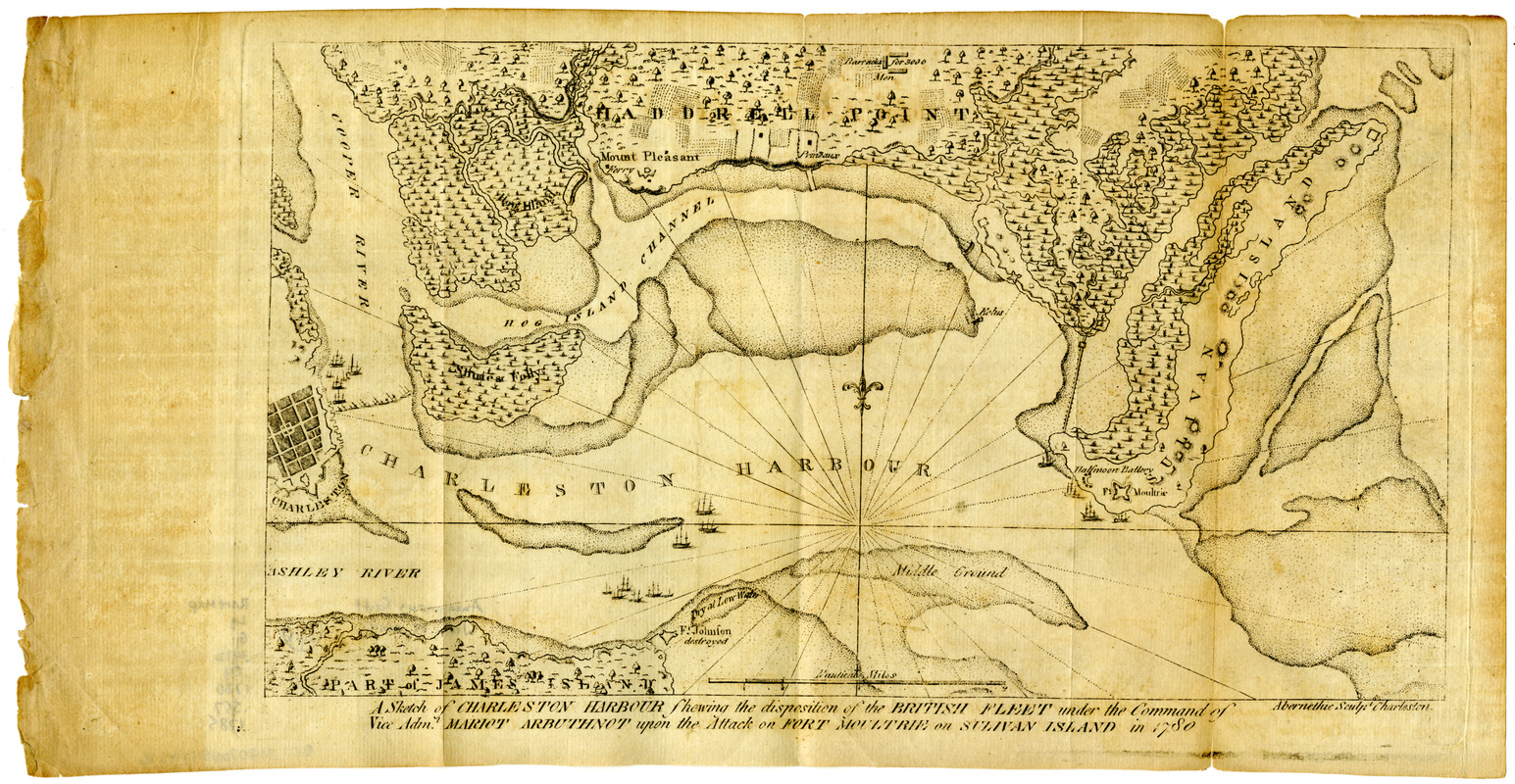
A sketch of Charleston Harbour : shewing the disposition of the British fleet under the command of Vice Adml. Mariot Arbuthnot upon the attack on Fort Moultrie on Sulivan Island in 1780
This map is also available in American Revolutionary Geographies Online (ARGO), a collections portal especially built for material relating to the American Revolutionary War Era. Visit ARGO to learn more about this item and explore the historical geography of North America in the late eighteenth century.
Item Information
- Title:
- A sketch of Charleston Harbour : shewing the disposition of the British fleet under the command of Vice Adml. Mariot Arbuthnot upon the attack on Fort Moultrie on Sulivan Island in 1780
- Engraver:
- Abernethie
- Printer:
- Collins, Isaac, 1746-1817
- Name on Item:
-
Abernethie sculpt Charleston.
- Date:
-
1785
- Format:
-
Maps/Atlases
- Location:
- Boston Athenaeum
- Collection (local):
-
Cartographic Collection
- Subjects:
-
United States--History--Revolution, 1775-1783--Maps--Early works to 1800
Charleston Harbor (S.C.)--Maps--Early works to 1800
- Places:
-
Charleston (county)Charleston Harbor (bay)
- Extent:
- 1 map ; 17 x 30 cm, on sheet 20 x 38 cm
- Terms of Use:
-
No known copyright restrictions.
This work is licensed for use under a Creative Commons Attribution Non-Commercial Share Alike License (CC BY-NC-SA).

- Publisher:
-
[Trenton, N.J.] :
Isaac Collins
- Scale:
-
Scale [approximately 1:50,000]
- Language:
-
English
- Catalog Record:
-
http://catalog.bostonathenaeum.org/vwebv/holdingsInfo?bibId=507544
- Notes:
-
Relief shown by hachures.
Detached from: Ramsay, D. The history of the revolution of South-Carolina, volume 2. Trenton : Printed by Isaac Collins, 1785.